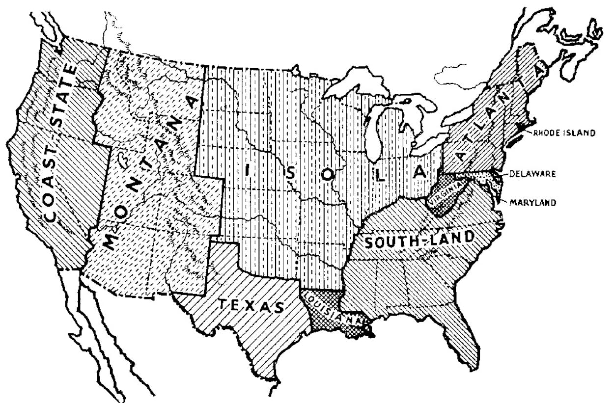
Every seventh-grader raised in Texas knows that the state was once its own country, but sometimes we have to remind the rest of the world. We’re larger than France, our GDP equal Canada’s, and while we don’t retain the right to secede from the United States (sorry, Governor), we could make a pretty good case for our ability to survive as a sovereign nation.
That’s what Frank Jacobs did in a post for the New York Times’ Opinionator, which analyzed two hypothetical maps by Leopold Kohr, an Austrian political scientist, “philosophical anarchist,” and father of the “small is beautiful” concept.
The map, from Kohr’s The Breakdown of Nations, was intended not to celebrate largeness but to illustrate its problems: “Whenever something is wrong, something is too big,” Kohr wrote. His hypothesis was that the U.S. would have been more stable as a collection of smaller dominated states than of larger, dominating states.
In Kohr’s map Texas was “big enough on its own” to be its own country, one that would probably be an aggressor state. But the state would eventually become too big to be effectively governed, according to Kohr, who wrote, “The absolute maximum to which a society can expand without having its basic functions degrade, is about 12 to 15 million people.” At over 25 million as of the 2010 census, Texas has far surpassed that maximum, and according to Kohr’s principles, would be ripe for division.
Well, there’s a map for that, too. Jacobs, who writes the “Strange Maps” column for Big Think, touched on it in 2011 when he wrote about Texas’s ability to break into five states. (Briefly: it is part of Texas’s statehood agreement that it may form up to four additional states with the approval of its populace.) Of course, splitting Texas in five still wouldn’t make any of the states “small.” It would also make what’s now Texas a lot “bigger”–the citizens of this area would get ten senators and an increase in electoral college voting power.
(Another Jacobs map, perhaps his most viral, showed the states as countries their GDPs approximated. We’re Canada!)
A few non-Texans have had a time making up names for these hypothetical states of, um, well, let’s call it “Quintexas.” In 2009, after Rick Perry infamously suggested the state could secede, noted electoral college number-cruncher Nate Silver took the challenge of dividing Texas into five states, naming them Plainland, Trinity, Gulfland, New Texas, and El Norte. (He wanted to know if “dividing a large, red state into five smaller, reddish states benefit Republicans in the Senate? In the Electoral College?” The short answer? Not enough to bother with the headache of splitting Texas.) 
Politico also took a shot at naming a five-state Texas, going with Big Bend, Gulfport, Panhandilonia, Piney Woods and Austinania. And in 1998 Mother Jones considered splitting all of the most populous states–including California, Illinois, Texas, and six others–and dubbed our five new states Tejas, Texahoma, Alamo, Petroland, and North Mexico (surely Texahoma was a joke).
Regardless of how Texas (or, if you prefer, Los Tejas) would benefit, it’s unlikely that a plan to divide the state would ever gain much support. Telling someone that El Paso is nearly as close to Los Angeles as it is to Houston isn’t as impressive if getting to Houston requires driving across three states, too.


