

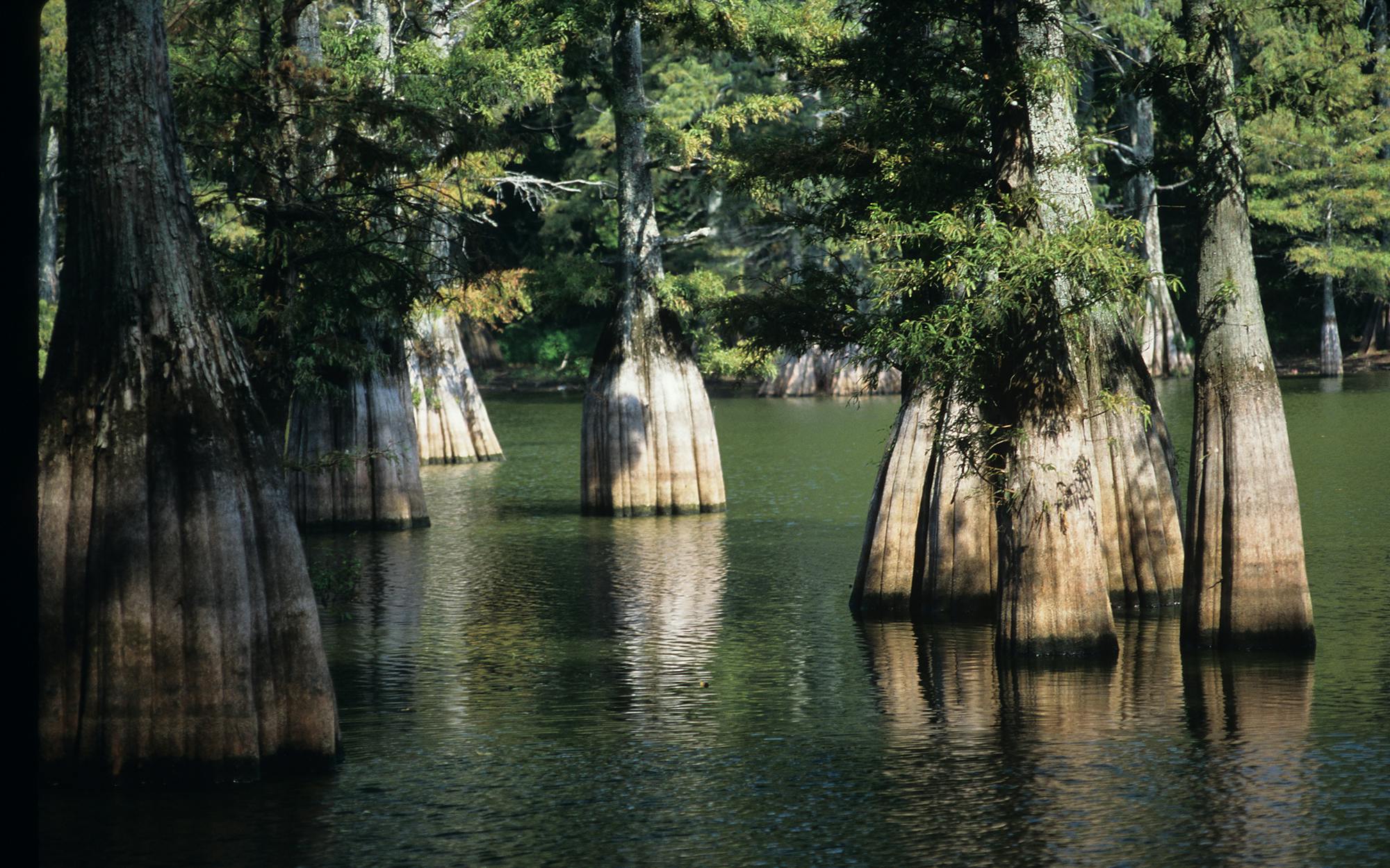
With the summer heat diminishing, it’s time to get outdoors again. To help you translate your good intentions into action, I’ve put together a list of thirty hikes. Each offers something special, whether it’s a comfortable stroll through shady woodlands or a steep climb to a remote summit. Going out on a limb, I’ve ranked the top ten hikes—ones that felt truly spectacular, at least on the day I went. So that you can pick the trail that’s right for you, I’ve marked them as easy, moderate, or hard. I’ve also noted the best season to go, as well as whether you can enjoy primitive camping, swimming, or birding. You can download detailed maps, or in most cases you can pick one up from the visitors center or park headquarters at each location. Every hike can be done in a day, but some provide the chance to pack a tent and spend a night or two out in the wild. Take plenty of water, wear stout boots, carry a good walking stick (or trekking pole), and soak up the state’s natural beauty. And when you return, visit texasmonthly.com and share your adventure.
1. South Rim
LOCATION: Big Bend National Park, 70 miles south of Marathon on U.S. 385
DIRECTIONS TO TRAILHEAD: Trails begin at the western end of the parking lot at the Chisos Basin, 9 miles from Panther Junction.
DISTANCE: 12- to 16.5-mile loop
FEE OR FREE: $15 park entrance fee (good for seven days)
CAUTION: Take plenty of water and be prepared for sudden changes in the weather.
TRAIL MAP
The most famous hike in Texas is also the best. No other route has the grandeur and scope of this trek up the southern edge of the Chisos Mountains, and no other trail rewards you with such a mind-blowing view. Thousands of feet below you, the Sierra Quemada badlands fade into the desolate ridges on the other side of the Rio Grande, in Mexico. And every time I visit Big Bend, something different and memorable happens; in July I walked through such thick clouds of orange-and-black butterflies that they could have been mistaken for leaves on the trees.
Start as early in the morning as you can, following the Pinnacles Trail as it rises past Casa Grande to the pass below Toll Mountain. A one-mile spur forks off to Emory Peak; at 7,832 feet it’s the highest point in the Chisos. The main trail edges around the northeastern side of Emory and dips into a wooded bowl at the north edge of Boot Canyon, one of the prettiest places I have ever seen, then continues along the canyon to the top of the South Rim. If you have the time (and the energy), add the 3.5-mile East Rim trail, with its own spectacular vistas of the Chihuahuan Desert. Shady forests and cool temperatures make this hike comfortable year-round, though thunderstorms are common in July and August.
As awe-inspiring as the views are from the South Rim, the soft haze of pollution has grown more noticeable, and I couldn’t help wishing that I could be transported even thirty years back, when I could have seen maybe one hundred miles into the distance. You should visit soon before the scenery disappears like the snows of Kilimanjaro.
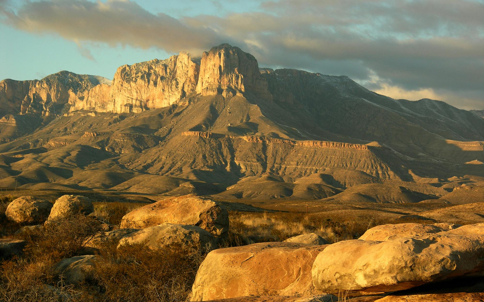
2. Guadalupe Peak
LOCATION: Guadalupe Mountains National Park, 110 miles east of El Paso on U.S. 62/180
DIRECTIONS TO TRAILHEAD: Trails begin in the RV parking area next to the Pine Springs campground at park headquarters.
DISTANCE: 8.4 miles
FEE OR FREE: $3 park entrance fee (good for seven days)
CAUTION: Winter and spring can bring winds of up to 120 miles per hour.
TRAIL MAP
To reach the top of Texas, you must climb 3,000 feet to Guadalupe Peak, which, at 8,749 feet, is the highest point in the state. Turn to the north to look down on the rest of the Guadalupe Mountains; to the south, over the prow of El Capitan, is an endless vista of bleak and rugged desert. On a clear day you might see the Davis Mountains, 125 miles away, or even all the way to the distant sierras on the other side of the border. After a few minutes of being buffeted by the strong winds that blast over this range, I felt as though I were sailing across the world on a giant ship.
On the climb, you pass through a forest of Douglas firs and ponderosa pines and then cross a meadow before the trail emerges out onto the bare mountainside for the last cruel switchbacks up to the peak. This is when you realize that the thing you thought was the top is not and you still have hundreds of feet to climb. At this point you may feel like turning around, but don’t give in. I’ve seen both eight- and eighty-year-olds reach the top, fueled by individual mixtures of enthusiasm and stubbornness. Only at the summit will you understand the deep satisfaction of knowing that everything you see is below you. Have someone take your picture by the odd pyramid that marks the peak, then head back to the bottom and celebrate with a cold beer. You deserve it.
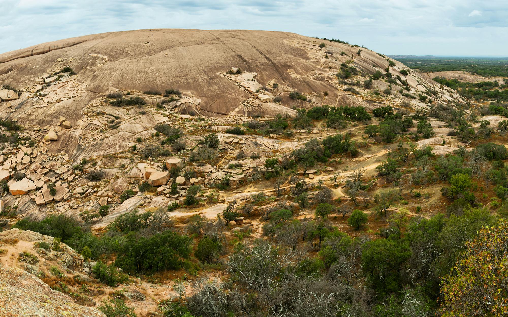
3. Enchanted Rock
LOCATION: Enchanted Rock State Natural Area, 18 miles north of Fredericksburg on RR 965
DIRECTIONS TO TRAILHEAD: Trails begin at the eastern end of the park headquarters’ parking lot.
DISTANCE: Summit trail: 1.2 miles. Loop trail: 4 miles
FEE OR FREE: $6
CAUTION: This spot is popular, so arrive early.
TRAIL MAP
You can’t call yourself a Texan until you have clambered up this irresistible lump of pink rock. The hike to the summit is demanding, but the panoramic views of the veldlike Hill Country from 1,825 feet above sea level are a stunning reward. Technically the rock is a batholith, a mass of molten magma that rose up to rest just below the earth’s surface. Wind and water then gradually revealed the naked granite and are now slowly demolishing it. The Tonkawa Indians heard the cries of dead men in the groaning rock, grinding against itself as it heated and cooled, and the Apache and Comanche used the mountain for rituals and vision quests, worshipping the sun from this auspicious vantage point. Sun worshipper or not, a few minutes in contemplation of nature at the summit is a welcome relief from life’s constant rush.
If you wish to extend your hike, consider heading southwest down into Echo Canyon and turning right, passing Moss Lake, to pick up the loop trail around Enchanted Rock and Freshman Mountain and back to the parking lot. It’s a perfect day for hikers of all ages—and it’s a trip they won’t soon forget.
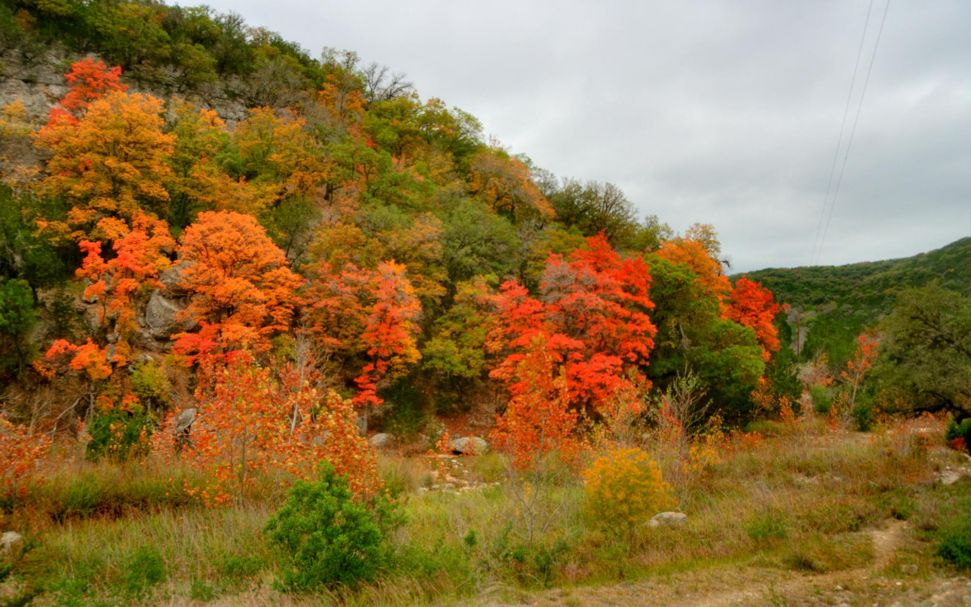
4. Lost Maples
LOCATION: Lost Maples State Natural Area, 5 miles north of Vanderpool on RR 187
DIRECTIONS TO TRAILHEAD: Trails begin at the main parking lots past the campground.
DISTANCE: 12.8 miles on multiple trails
FEE OR FREE: $5
CAUTION: Flash floods are common.
TRAIL MAP
Admiring the fall foliage at Lost Maples is another Texas ritual, and rightly so. This park is set in the most beautiful and remote part of the Hill Country, on the Edwards Plateau. It’s a place of clear rivers, rough canyons, and thickly wooded banks and is home to the isolated stand of bigtooth maples that gives the park its name. Each fall they delight visitors with a spectacular display of bright oranges and reds, lovingly documented week by week on the park’s Web site (check out the Foliage Color Change Report at tpwd.state.tx.us). Last year the trees put on the best pageant in several years. Let’s hope this fall is as good.
The trails mainly follow the pristine Sabinal River and its tributaries, with long flat stretches and short but rapid changes in elevation. Wildlife is abundant, and you might see a rarity like a green kingfisher or one of the red-tailed hawks that nest on cliff faces in the park. Most of the time the route is shaded by a canopy of tree limbs, so the sudden panorama of the surrounding country from the West Trail above Mystic Canyon is that much more dramatic.
5. Four C National Hiking Trail
LOCATION: Davy Crockett National Forest, 20 miles east of Crockett on Texas Highway 7
DIRECTIONS TO TRAILHEAD: Ratcliff Lake Recreation Area: 1 mile west of Ratcliff on Texas Highway 7. Neches Bluff: From Alto, take Texas Highway 21 west for 7 miles, turn left on FS 511-3, go .5 mile, and turn left on FS 511-A.
DISTANCE: 20 miles one way
FEE OR FREE: $3 if parking at Ratcliff Lake
CAUTION: Avoid this trail during deer season, from November 4 through January 7, or wear bright “hunter orange” clothing.
NO MAP AVAILABLE
A friend and I started along this trail from the north end a few months ago, but we didn’t make it very far, as we stopped every few steps to identify mayhaws, muscadine vines (yes, with grapes, and you can get wine made from these at the Maydelle winery, outside Rusk), white oaks, swamp chestnut oaks, and … well, you get the picture. The casual traveler through East Texas could easily dismiss every tree as either pine or not and miss the mind-boggling variety that made me think of an eager magician constantly producing rabbits from his hat. The 4C (the name comes from the defunct Central Coal and Coke Company) takes you through the full spectrum of our eastern forests, passing under tall stands of loblolly pine, hardwood bottomlands, upland forest, and the swampy quagmires known as sloughs. After a while (and away from the roads) you can almost hear the roar of creation in action, the sound of plants fighting for light and water.
Any part of this trail makes for a great day hike. The view from the Neches Bluff Overlook, across the river bottomlands, is as gorgeous as any in Texas and is less than a mile from the trailhead. Forest Service Road 511 crosses the trail, and from it you can more directly access remote sections like the Big Slough Wilderness Area, a maze of boggy creeks and backwaters shadowed by huge cypresses. Lastly, Lake Ratcliff makes a delightful base camp from which to explore the southern end of the trail.
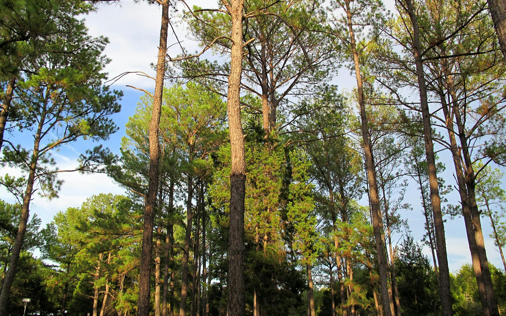
6. Lost Pines Trail
LOCATION: Bastrop State Park, 1 mile east of Bastrop on Texas Highway 21
DIRECTIONS TO TRAILHEAD: At the park headquarters, turn right on Park Road 1A. The parking for the trailhead is on the left.
DISTANCE: 8.5-mile loop
FEE OR FREE: $4
CAUTION: Stay on the trail; it’s easy to get lost in the forest.
TRAIL MAP
Sandy soil and pine needles underfoot might make you think you are in East Texas, but the rugged terrain is more like the Hill Country. These are the 18,000-year-old lost pines of Bastrop, by the vagaries of geology the westernmost stand of loblollies in the country.
The Lost Pines Trail makes a loop through these lovely woods that are two forests in one, thanks to the oak and other deciduous trees that thrive under the evergreens. Make sure to spend a moment at each of the lookout points—one at the trailhead and the other at Fehr’s Overlook. Frequent sharp hills and gullies make some portions of the trail quite strenuous, and overall there is a 165-foot change in elevation. These grades and the moderate length make this excursion excellent training for longer hikes, and since primitive camping is allowed in many parts of the forest, it also offers a chance to see if overnight hikes are your thing. Birders, take note: Two hundred species have been sighted in the park.
7. Cross Timbers Trail
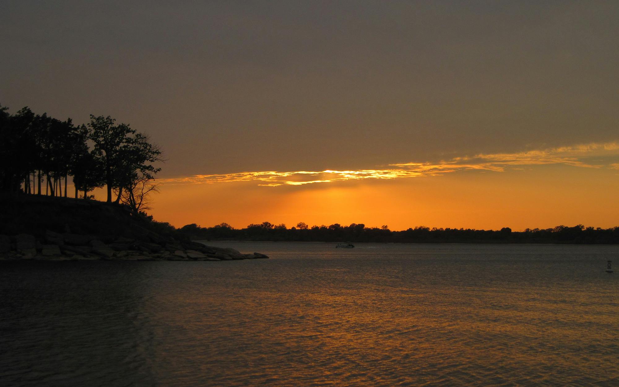
LOCATION: Lake Texoma, 15 miles north of Whitesboro on U.S. 377
DIRECTIONS TO TRAILHEAD: Park at the F area lot at Juniper Point Park West, by the lake, just west of U.S. 377.
DISTANCE: 14 miles one way
FEE OR FREE: Free
CAUTION: Keep an eye out for copperheads and rattlers, and beware of ticks, chiggers, and other biting insects.
TRAIL MAP
Built in 1969 by the Army Corps of Engineers, the trail tracks the south shore of Lake Texoma. From the starting point at Juniper Point to Cedar Bayou, high rocky ledges offer grand views of the lake and its surroundings. Once past Cedar Bayou, there’s only the occasional glimpse of blue as the path disappears into a tangle of shady limbs. This stocky blackjack oak woodland is part of two bands of thick forest—the Cross Timbers—that at one time reached deep into Oklahoma and were described in the nineteenth century as being “uninhabitable to man or beast.” The trail zigs and zags up and down steep brush-covered banks, and it’s easy to see why early attempts to hack a path through the woods were so frustrating. Beyond Paw Paw Creek Resort, the route flattens out and passes through several rather trashy public-use areas; I recommend that you don’t bother with this part.
From Juniper Point to Cedar Bayou and back is roughly 5 miles, and Cedar Bayou to Paw Paw Creek and back is 11 miles. A shorter option is to go from Cedar Bayou (for directions and information, go to cedarbayou.com) around Lost Loop and back, which is only 3 miles. On Lost Loop there are two or three places where you can get down to the water’s edge; I took the opportunity to cool off with a dip in the lake.
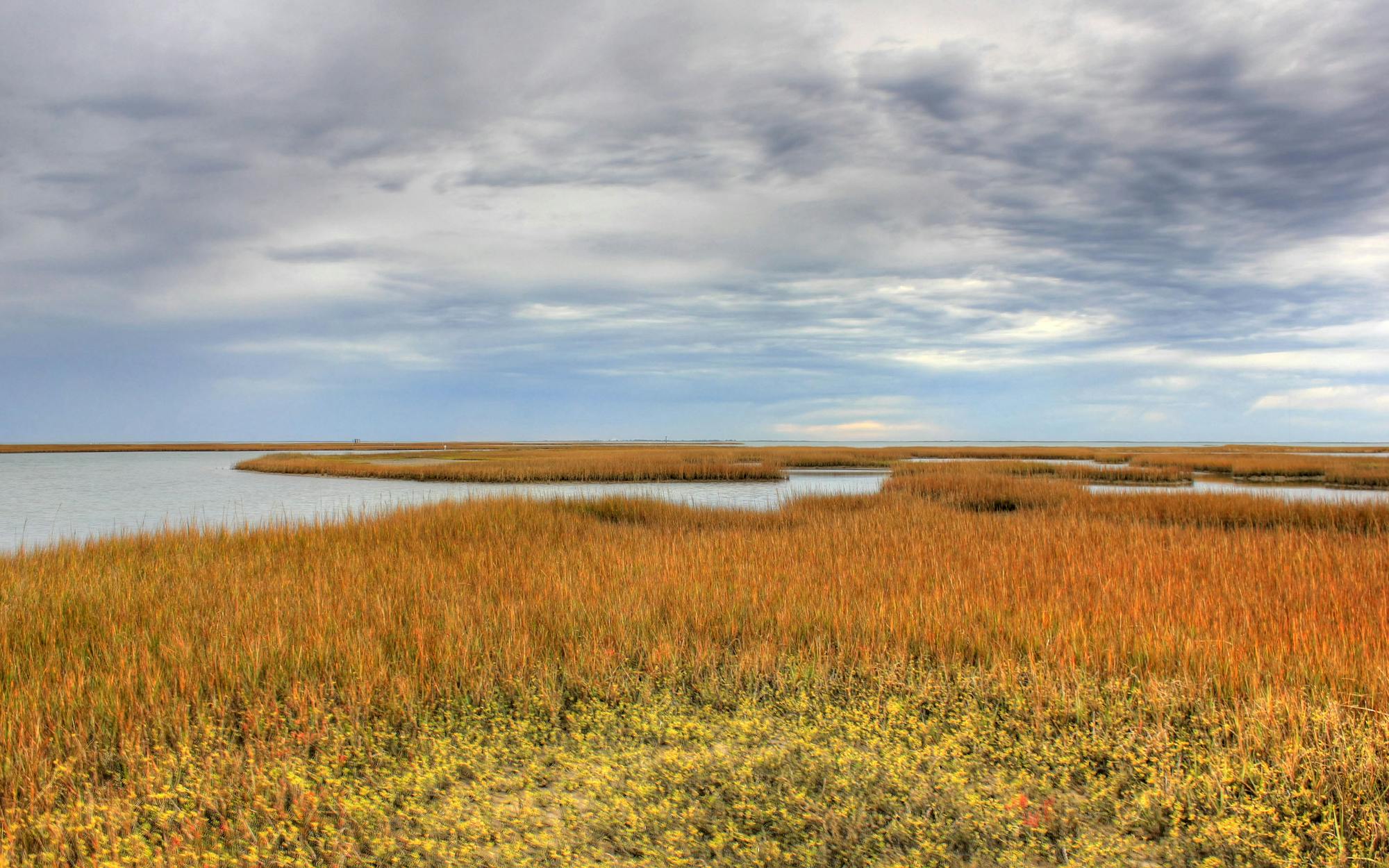
8. Galveston Island
LOCATION: Galveston Island State Park, 6 miles southwest of Galveston on FM 3005
DIRECTIONS TO TRAILHEAD: From the main entrance, head to the northern section of the park.
DISTANCE: 4 miles on multiple trails
FEE OR FREE: $5
CAUTION: Take water and sunscreen.
TRAIL MAP
What, you are thinking, is Galveston Island State Park doing on a list of the best hikes in Texas? The answer is that these two thousand acres of dunes, marshlands, and briny inlets present a rare chance to immerse yourself in the multifarious wonders and diverse ecologies of a shoreline that is threatened both by natural disasters and by development. The trails meander through the park’s bay-side section, where coastal prairie butts up against the tidal wetlands and narrow bayous reach deep into salt meadows that are dotted with freshwater ponds. There’s no obvious route, but I suggest that you start with the inner loop and then make your way around the interpretive trails and boardwalks before wandering out to the farthest observation platform. Salty sloughs and oak motts provide cover for everything from coyotes to turtles. It’s a bird-watcher’s and photographer’s paradise, and the first rule of photography—no breakfast before ten o’clock—certainly applies here. When I visited recently, I saw egrets, herons, and other waders everywhere. From the platform’s vantage point, the large birds, standing quietly in the flat, green expanse, seemed for all the world like pieces in some strange Through the Looking Glass chess game, patiently waiting to be told their next move.
9. Palmetto State Park
LOCATION: 6 miles south of Luling, just off U.S. 183
DIRECTIONS TO TRAILHEAD: From U.S. 183, take Park Road 11 through Ottine (the park headquarters is in the center of town) and turn left after you cross the San Marcos River, staying on Park Road 11. The main trails begin near the parking lot on the left.
DISTANCE: 3 miles on multiple trails
FEE OR FREE: $3
CAUTION: Watch out for poisonous snakes.
TRAIL MAP
Lost pines, lost maples—to that list add nature’s comic riposte, the lost dwarf palmettos of Ottine, grouped like a vegetable Scout outing around the village swamp. This bog, a survivor from an earlier, wetter era, supports a quasi-tropical range of plants that is very different from the surrounding rolling post oak woodlands. In dry times they are kept alive by an artesian well, a handsome Civilian Conservation Corps construction project. Clustered together under a canopy of oak and elm trees, the little palmettos are the most distinctive of some 500 plant species found here. The short interpretive trail—pick up a booklet at the trailhead—points out some of the best specimens as it loops through the thickest part of the swamp, which after a good rain can look as lush and green as a jungle. The unusual vegetation attracts 250 species of birds, one more reason to while away a couple of hours at this charming spot.
10. Kirby Trail
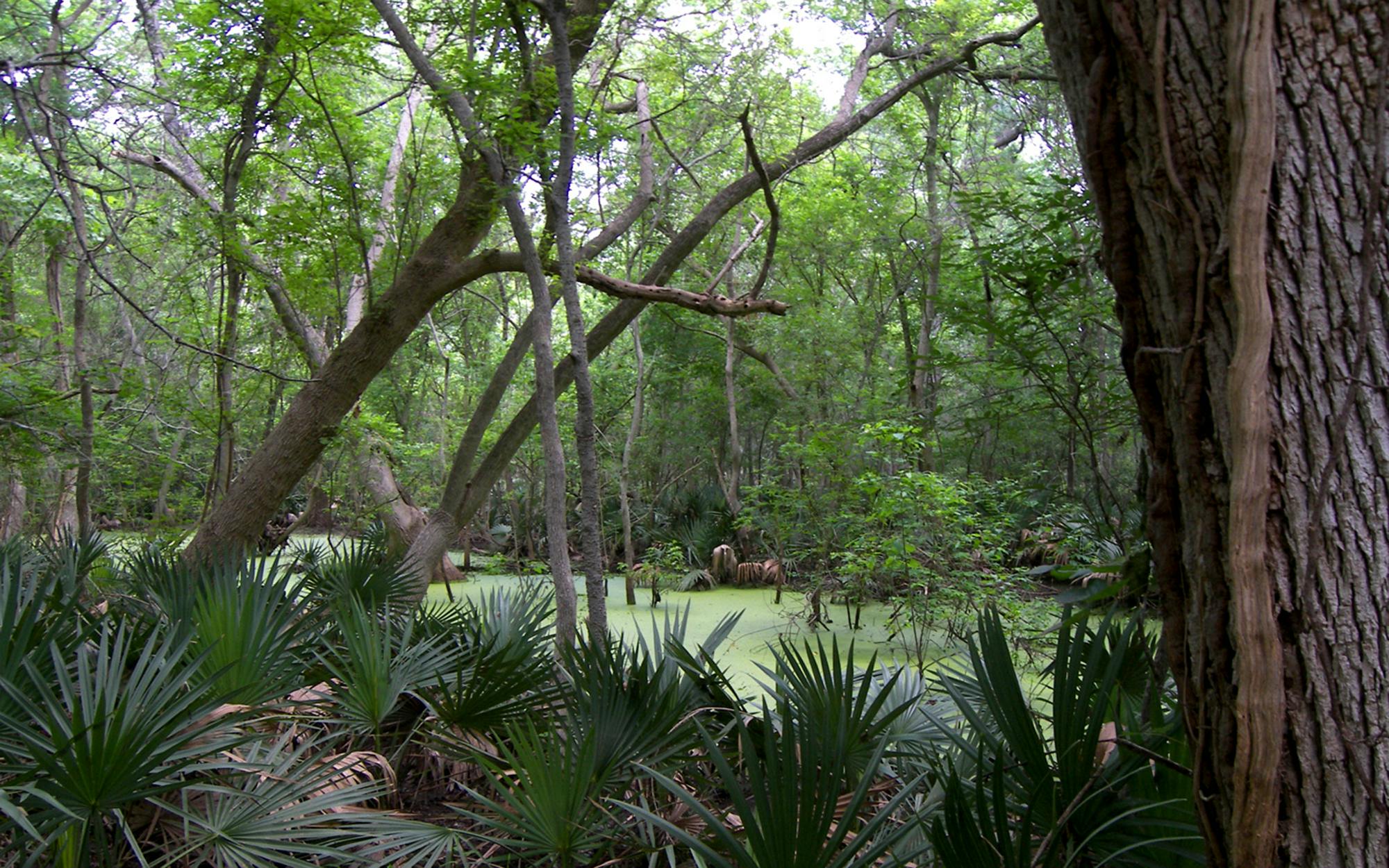
LOCATION: Big Thicket National Preserve, 7 miles north of Kountze on U.S. 69 and 2.5 miles east on FM 420
DIRECTIONS TO TRAILHEAD: Trails begin on FM 420, 1.5 miles past the visitors center.
DISTANCE: 2.5-mile loop
FEE OR FREE: Free
CAUTION: Wear bug spray. Lots of it.
NO MAP AVAILABLE
I had never heard the word “baygall” before hiking this trail, but now I know that it refers to a bog in a forest and is apparently derived from the bay trees and gallberry holly bushes that flourish in rank ponds, dyed black from the tannin in the leaves. You’ll learn that and a lot more about the ecology of East Texas on this hike, which loops through a rare slope forest of beech, magnolia, and the ubiquitous loblolly pine trees and past cypress-shaded sloughs to Village Creek (where the 17.5-mile Turkey Creek Trail begins).
It’s a crash course in the wild, writhing, cannibalistic aliveness of nature in the raw, and on a recent visit, I was both awed by the flora and cowed by the fauna. Mosquitoes hovered in Starfleet battle formation, waiting for me to take the slightest pause; huge golden orb spiders had built their webs right at mouth level; and underfoot tiny toads (smaller than a fingernail) and miniature snakes hopped and slithered out of the way as I walked by, dripping with sweat. Despite the discomfort and the ick factor, this short hike was one of my favorites, especially since I had taken the time to study the exhibits in the visitors center. It’s amazingly satisfying to know the name of what you are staring at.
Twenty More Great Routes
Barton Creek Greenbelt
LOCATION: Austin
DIRECTIONS TO TRAILHEAD: Numerous access points around Town Lake include Camp Craft Road, Loop 360, and Spyglass Drive.
DISTANCE: 7 miles on multiple trails
FEE OR FREE: Free
CAUTION: Watch out for the gung ho bicyclists.
TRAIL MAP
Eight hundred acres of greenery make an idyllic retreat for hikers, bikers, kayakers, swimmers, and sunbathers for whom this is no escape from city life—it is city life. For that, residents say, “Amen, brother.”
Bentsen–Rio Grande Valley State Park
LOCATION: 5 miles southwest of Mission on Bentsen Palm Drive
DIRECTIONS TO TRAILHEAD: Trails begin at various points on Park Road 43.
DISTANCE: 4 miles on multiple trails
FEE OR FREE: $5
CAUTION: None
TRAIL MAP
The World Birding Center does indeed attract (human) visitors from all over the world, who flock here to see both indigenous avian rarities and their friends from over the border. Join the Hawk Watch in October to see migrators such as Swainson’s hawks and Mississippi kites.
Bush Mountain
LOCATION: Guadalupe Mountains National Park, 110 miles east of El Paso on U.S. 62/180
DIRECTIONS TO TRAILHEAD: Trails begin in the RV parking area next to the Pine Springs campground at park headquarters.
DISTANCE: 17 miles round-trip
FEE OR FREE: $3 park entrance fee (good for seven days)
CAUTION: Watch for high winds and winter storms.
TRAIL MAP
Another wonderful hike in the Guadalupe Mountains, although the strenuous ascent from Pine Springs and the high altitude—much of the route is above eight thousand feet—make this a no-no for beginners. Experience is rewarded with unbelievable views and, most likely, complete solitude. A must for serious Texas hikers.
Canyon of the Eagles Lodge and Nature Park
LOCATION: Lake Buchanan, outside Burnet on FM 2341
DIRECTIONS TO TRAILHEAD: Trailheads are along the paved road through the park.
DISTANCE: 14 miles on multiple trails
FEE OR FREE: $5
CAUTION: None
NO MAP AVAILABLE
Wander for hours around a network of trails that ranges from the lakeshore up to 1,100 feet (you’ll never get lost, thanks to the sturdy and accurate trail maps that the lodge provides). Bald eagles nest here, joining the Hill Country’s two most famous endangered species, the black-capped vireo and the golden-cheeked warbler, so bring your binoculars.
Caprock Canyons State Park and Trailway
LOCATION: Quitaque, 3.5 miles north of Texas Highway 86 on FM 1065
DIRECTIONS TO TRAILHEAD: Park trails and the trailway have numerous access points; maps are available at texasmonthly.com/hiking.
DISTANCE: More than 90 miles on multiple trails
FEE OR FREE: $3
CAUTION: Don’t bite off more than you can chew.
TRAIL MAPS: Park Trailway
What a bounty! Some 30 miles of trails (a few are still under construction) in the park as well as the 64-mile trailway make for a hiking paradise. In the park, the 7-mile Upper Canyon trail is the best (but toughest), with spectacular views of the red rock formations, and Eagle Point trail is a great choice for the less experienced hiker.
Cibolo Wilderness Trail
LOCATION: Boerne City Park, off Texas Highway 46 on City Park Road
DIRECTIONS TO TRAILHEAD: Follow signs to the trail and park at the pavilion.
DISTANCE: 3.5 miles
FEE OR FREE: Free
CAUTION: None
TRAIL MAP
Tucked away in the back end of Boerne City Park, this trail is a forgotten gem where you can find tranquillity while you rest under tall cypress trees near beautiful Cibolo Creek.
City of Denton Greenbelt
LOCATION: East of Denton between Lake Ray Roberts and Lake Lewisville
DIRECTIONS TO TRAILHEAD: Access from Elm Fork Park on FM 455, City Park on FM 428, and Greenbelt Corridor Park on U.S. 380
DISTANCE: 10 miles one way
FEE OR FREE: Free
CAUTION: None
NO MAP AVAILABLE
This flat paved trail shadows the Elm Fork of the Trinity River between the two lakes and passes underneath the cottonwoods and other tall hardwood trees that flourish in the river bottoms. A nice shady walk on a summer afternoon.
Davis Mountains State Park to Fort Davis National Historic Site
LOCATION: Davis Mountains State Park, 1 mile north of Fort Davis on Texas Highway 118
DIRECTIONS TO TRAILHEAD: Trails begin on Park Road 3A (Skyline Drive).
DISTANCE: 7.5 miles round-trip
FEE OR FREE: $3 entrance fee for the state park, $3 for the historic site (good for seven days)
CAUTION: Be aware of some steep, rocky sections.
TRAIL MAP
A lovely hike from the state park into Fort Davis takes you over high grasslands, rocky juniper, and oak-covered slopes on your way to the beautifully preserved fort. Stop at the highest point to enjoy the view of Fort Davis and the Chihuahuan Desert.
Lake Mineral Wells State Park
LOCATION: 4 miles east of Mineral Wells on U.S. 180
DIRECTIONS TO TRAILHEAD: From park headquarters, turn left across the spillway, then take another left to the parking lot by the Cross Timbers camping area.
DISTANCE: 5-mile loop
FEE OR FREE: $5
CAUTION: None
TRAIL MAP
As might be expected in cowboy country, most of the trails in the park carry a good amount of horse traffic, but the route out to the backcountry camping area is for hikers only and makes a beautiful evening stroll as the sun goes down. You scramble over rocky terrain through a bantam oak forest for the first half mile before the trail leaves the lake behind and continues through grassy clearings to the camp site.
Lake Somerville Trailway
LOCATION: Lake Somerville State Park, outside Somerville
DIRECTIONS TO TRAILHEAD: The trailway links the Nails Creek and Birch Creek units of the state park. Nails Creek: From Giddings, take U.S. 290 east for 6 miles, then turn north on FM 180 and proceed to the park. Birch Creek: From Somerville, take Texas Highway 36 north for 4 miles, turn west on FM 60 for 7.6 miles, then turn left on Park Road 57.
DISTANCE: 13 miles one way
FEE OR FREE: $3
CAUTION: None
TRAIL MAP
Open to mountain bikers and horseback riders as well as hikers, the sandy trail makes a loop round Lake Somerville through shady post oak and hickory forests. Look for bright red berries on female yaupon holly trees. Various loops and spurs allow you to customize the route, with the circumnavigation of Flag Pond a popular choice when starting from Nails Creek.
McKinney Roughs Nature Park
LOCATION: 8.4 miles west of Bastrop on Texas Highway 71
DIRECTIONS TO TRAILHEAD: Trails start near the visitors center.
DISTANCE: 16 miles on multiple trails
FEE OR FREE: $3
CAUTION: The trails are long and rugged, so know your limits.
TRAIL MAP
Rocky canyons, flower-covered meadows, and best of all, the cool and lazy Colorado River await the hiker at this park, where what feels like a limitless combination of trails takes you through a variety of terrains. From the high ridges there are wonderful views over the bucolic landscape north of the river.
McKittrick Canyon
LOCATION: Guadalupe Mountains National Park, 7 miles north of Pine Springs off U.S. 62/180
DIRECTIONS TO TRAILHEAD: Trail begins at the visitors center, which is 5 miles from the highway.
DISTANCE: 7 miles round-trip
FEE OR FREE: $3 park entrance fee (good for seven days)
CAUTION: Trail is day-use only, 8 a.m.– 6 p.m. April through October and 8 a.m. to 4:30 p.m. November through March.
TRAIL MAP
It’s tough not to be able to put this in the top ten. It’s gorgeous at any time of year, but in the fall the maples and other deciduous trees fill the canyon with myriad shades of red, yellow, orange, and brown, earning this place the soubriquet of “the most beautiful spot in Texas.” It’s also high on the list of “most visited spots in Texas,” but the views are worth the crowds. Type A loners can hike an extra 4 miles up the steep trail to McKittrick Ridge for better views and more elbow room.
Milton Reimers Ranch Park
LOCATION: 30 miles southwest of Austin. Take Texas Highway 71 west of Austin through the town of Bee Cave and turn left on FM 3238 (Hamilton Pool Road). Travel 12 miles to the park entrance, on your right.
DIRECTIONS TO TRAILHEAD: Follow the park road to the parking lot on the left.
DISTANCE: 3 or 4 miles on several (unmarked) trails
FEE OR FREE: $8
CAUTION: The road to the park entrance is long and rough—your Mini won’t make it.
NO MAP AVAILABLE
While the hoi palloi wait in line for parking spots at Hamilton Pool, you can slip into Reimers Ranch and enjoy 3 miles of Pedernales River frontage—with a rope swing even. Hike the picturesque canyon at the front of the parking lot down to the river.
Pineywoods Nature Trail
LOCATION: Lake Livingston State Park, 5.5 miles southwest of Livingston on Park Road 65
DIRECTIONS TO TRAILHEAD: Turn right at the junction after park headquarters, and the trailhead is on the right just past the parking lots.
DISTANCE: 1 mile
FEE OR FREE: $3
CAUTION: Watch out for the equestrian-only trails.
TRAIL MAP
Kids will love this hike through a forest of loblolly pine trees and water oaks and past a sunflower field full of butterflies to a duck pond where hummingbirds also play. Too bad the pond has become rather run-down.
Rancherías Canyon Trail
LOCATION: Big Bend Ranch State Park, 4 miles east of Presidio on FM 170
DIRECTIONS TO TRAILHEAD: The West Rancherías trailhead is on the north side of FM 170, 22 miles west of Lajitas.
DISTANCE: 10 miles round-trip
FEE OR FREE: $3
CAUTION: Trail markers (rock cairns) can be hard to follow.
TRAIL MAP
Not to be confused with the more arduous Rancherías Loop, this prettier trail climbs gradually up the Rancherías Canyon deep into the Bofecillos Mountains, passing through a high alpine meadow to dead-end at the Rancherías Falls. Try to visit after a good rain to see the falls in action.
Santa Ana National Wildlife Refuge
LOCATION: 7 miles south of Alamo on FM 907; turn left on U.S. 281 to entrance.
DIRECTIONS TO TRAILHEAD: From Panther Junction, head west toward Study Butte for 13 miles, then turn left (follow signs for Castolon) and continue for 30 miles to the trailhead.
DISTANCE: 12 miles on multiple trails
FEE OR FREE: $3
CAUTION: None
NO MAP AVAILABLE
Nearly four hundred species of birds, including migrating raptors and Rio Grande specialties like groove-billed anis and chachalacas, depend on this scrap of subtropical woodlands, a startling oasis in the flat Valley farmland, which is rightly considered the crown jewel of the refuge system. Resacas— oxbow lakes—surrounded with moss-covered trees add to the feeling of having entered a lost world.
Santa Elena Canyon
LOCATION: Big Bend National Park, 70 miles south of Marathon on U.S. 385
DIRECTIONS TO TRAILHEAD: Trails begin at the visitors center.
DISTANCE: 1.7 miles round-trip
FEE OR FREE: $15 park entrance fee (good for seven days)
CAUTION: Be careful crossing Terlingua Creek, which can flood quickly.
TRAIL MAP
What to write about Santa Elena in only a sentence or two? Maybe I’ll just say that the last time I was there I was soaked from head to toe by a storm battering against the canyon mouth, while high above the sun was shining, bathing the thousand-foot rock walls and the Rio Grande with golden light. Two rainbows were suspended across the river. That kind of experience is why I go hiking.
Seminole Canyon State Park
LOCATION: 9 miles west of Comstock on U.S. 90, just east of the Pecos River
DIRECTIONS TO TRAILHEAD: Continue on Park Road 67 from the park headquarters. Trailhead is on the left before the campgrounds.
DISTANCE: 6 miles round-trip
FEE OR FREE: $3
CAUTION: None
TRAIL MAP
Stop here at any time on your way to or from Big Bend, just for the views over Amistad Reservoir and the large pictograph of a panther that are waiting at the farthest point. I will always remember a day in April when the arid limestone was transformed into a flourishing garden of daisies, verbena, and flowering cacti, and flocks of birds danced in front of me as I hiked. Maybe you too will be lucky enough to catch this park in bloom.
Smith Spring
LOCATION: Guadalupe Mountains National Park, 110 miles east of El Paso on U.S. 62/180
DIRECTIONS TO TRAILHEAD: Trail begins at Frijole Ranch, about 2 miles north of Pine Springs on U.S. 62/180.
DISTANCE: 2.5-mile loop
FEE OR FREE: $3 park entrance fee (good for seven days)
CAUTION: None
TRAIL MAP
A desert oasis, Smith Spring is one of the few reliable water sources in the Guadalupe Mountains, and all sorts of animals trek miles down from the high valleys to refresh themselves. Early morning and dusk are, as usual, the best times for rare glimpses of the locals.
Wolf Mountain Trail
LOCATION: Pedernales Falls State Park, 6.5 miles north of U.S. 290 on FM 3232, near Dripping Springs
DIRECTIONS TO TRAILHEAD: Trail starts at the parking area on the right, just past the park headquarters.
DISTANCE: 7-mile loop
FEE OR FREE: $5
CAUTION: Some portions of this trail are on a rock road, which makes for tough going after a while.
TRAIL MAP
Stunning views of the Pedernales River valley are your reward on this hike, which takes you through classic Hill Country terrain to a circle round Wolf Mountain. Jones Spring, where water trickles down a gorgeous little limestone canyon, makes an excellent rest stop.
SaveSave


