

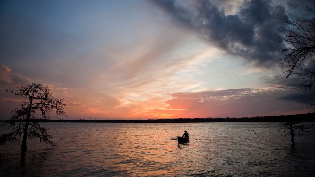
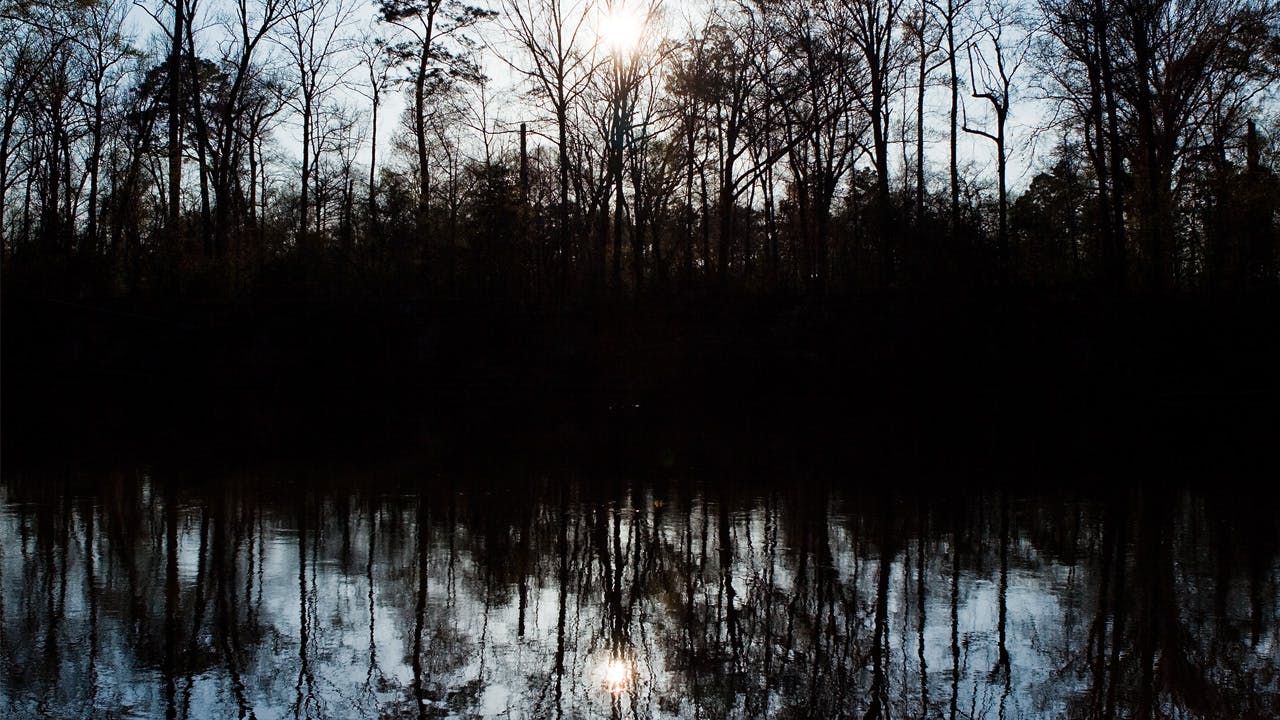
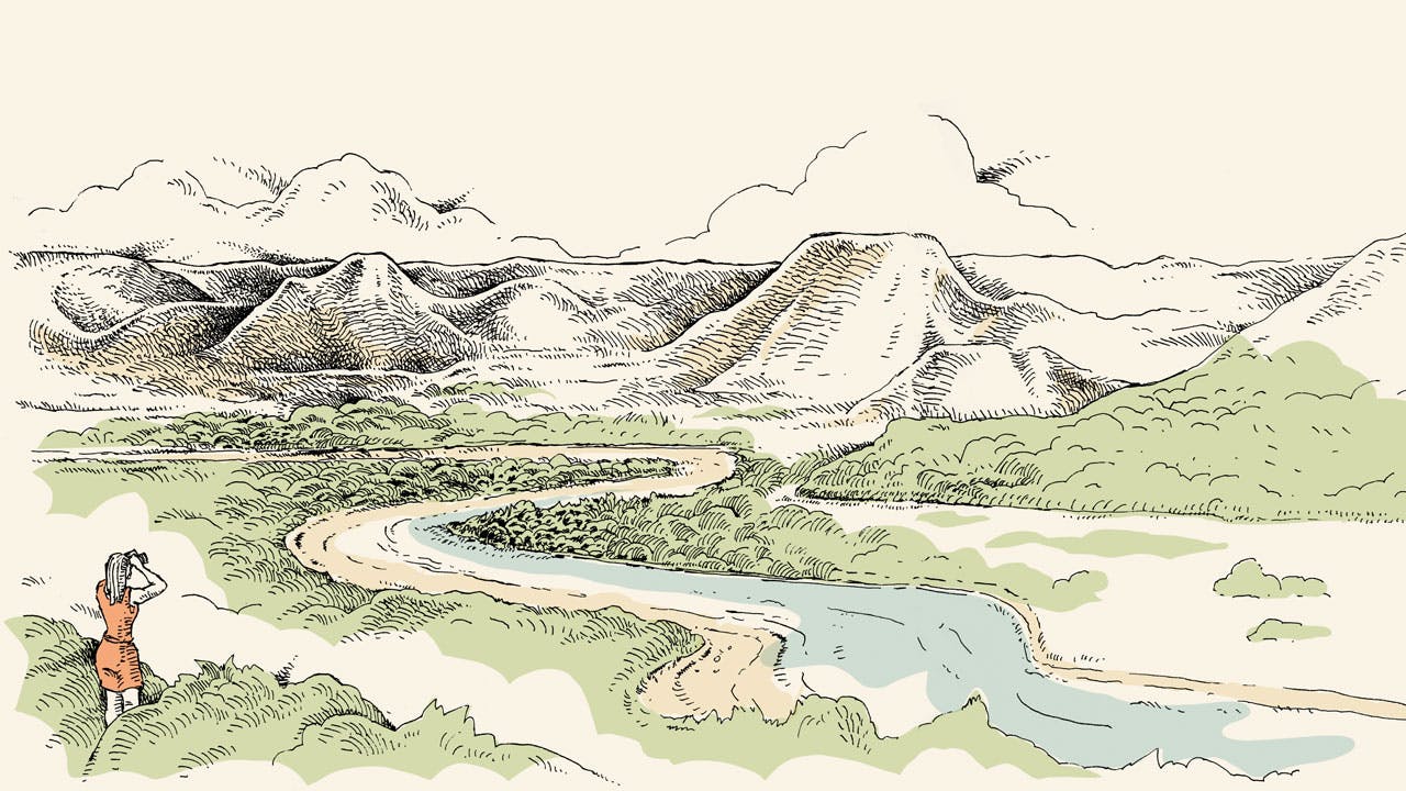
of drought and flood, we know in our bones how important water is to Texas. Without it, everything dies. But though we obsess over the state of our reservoirs, we sometimes overlook the moving bodies of water that feed them. Texas has fifteen major river basins, which irrigate our crops, power our cities, and give us water to drink. But such demands mean that there is often little water left for the rivers themselves, which is cause for concern. Healthy rivers, with abundant plant and animal life, are a sign of a healthy environment. They’re also wonderful places to play, relax, and sightsee—or even test your mettle. With that in mind, I set out to find the twenty best stretches of river in Texas to showcase the variety of experiences that are possible on—and in one case, alongside—moving water. Some of these trips took a few hours, some a few days; I drifted through a desert in a snowstorm, battled a West Texas rapid, and sipped whiskey while gazing up at the stars. In short, there’s something for everyone on this list, even if you’ve never sat in a canoe in your life. I like to think of rivers as time machines with two primary functions. The first helps us live more fully in the present moment; the second allows us to sense the ever-present hiss and rumble of geologic time. The history of this country, after all, is not written in stone carved by men, like the cathedrals of Europe. It’s written in the canyons our rivers have carved across America, in their forks and sandbars, and in the forests and hills they run through. It’s the history of the continual creation of the earth; on our state’s rivers you will always be able to find paradise.
Things to know
The Rules of the RiverThe right to free passage on our waterways rests on a vague 1863 ruling by the Texas Supreme Court that affirms the “settled policy and cherished object of the state to guard its navigable streams from obstruction and to secure and improve them as common highways of trade and travel.” Without getting mired in the question of whether floating down the Guadalupe with a beer in your hand qualifies as either trade or travel, the fact is that there is very little publicly owned riverfront property in Texas, and the laws on where the river ends and private property begins are often unclear. So . . . Rule number one: Respect private property. Landowners dislike trespassers, and even if you are camped lawfully on a sandbar, someone’s home or hunting cabin may be just over the rise, and those folks will be fully aware that you are there, especially if you’re throwing a party. If challenged, be polite and be prepared to leave. You may also want to carry cash so you can offer to pay for the use of a site. That said, I’ve spent many evenings at the water’s edge and have never been hassled. Rule number two: Respect the river. When you leave your campsite or picnic site, remove any trace of your presence. Take your trash home and bury your business. Rule number three: Respect the elements. Pack your stuff in waterproof bags (there’s a difference between waterproof and water-resistant). Carry a hard plastic case for your camera, cell phone, et cetera, and fasten everything in. It’s one thing to get wet, quite another to get wet and lose the cooler. Also, no cotton underwear. What to Bring Many places mentioned in this story don’t offer a particularly convenient canoe rental or shuttle service, so it will probably be easier to bring a boat with you. Take water (or a water filter), first-aid gear, and a wet suit and neoprene booties and gloves if it’s cold. And wear a flotation device even on the calmest-looking river. Webbing lines attached to the front and rear of your boat are essential for portaging and guiding it down tricky rapids. When to Go May and September are great months for boating, and the recent wet winter has raised water levels (though two years of drought mean they’re still not as high as one would like). The U.S. Geological Survey (waterdata.usgs.gov/tx/nwis/) gives stream-flow data that will help you plan, but note that flow can depend on dam release and changes quickly. A heavy rain upstream can cause severe flooding without your even seeing a cloud, so be careful where you camp; this evening’s primo spot may be a torrent in the morning. What to Do With Your Car Make sure you park legally. On some trips you may leave a vehicle unattended for a couple of days; you don’t want to return to find that it has been ticketed or towed. Trips are easier with two vehicles; with just one, you’ll need to arrange a shuttle or rely on the kindness of strangers to get back to where you started from. Parking should be easy, unless otherwise noted.
Trinity River
Difficulty: Moderate
Section A loop through Trinity River delta, access at Cedar Hill Park, on Lake Charlotte Road, near Wallisville
Difficulty Moderate
Length and duration 6–7 miles, 4–5 hours
Resources Tours arranged through Houston’s Sierra Club.
Reward yourself Bring a picnic to enjoy by Lake Charlotte.
Many picturesque river trips require a five-hour drive to the middle of nowhere; others are nearly as accessible as your local Costco. Houstonians looking for a quick change of scenery should head east on Interstate 10. Once you get through Baytown and Mont Belvieu, the sprawl suddenly ends; the highway lifts off and flies across a big estuary, only to land in a flat delta; and the horizon is empty. You are in the Trinity River Basin, a maze of sloughs and bayous created by thousands of years of sediment deposit and the subsequent shifting of the main river channel, which itself winds unconcernedly through an untidy labyrinth into Trinity Bay. Cypress trees dominate the landscape and constitute the largest cypress forest on the Texas coast.
To experience this swampy wonderland, make your way across Lake Charlotte and along Mac Bayou to the Trinity, which takes you through three ecosystems and many centuries of human history. The discarded shells underfoot at the put-in are evidence that long ago this was an American Indian campground. The area was also the site of skirmishes that established the border between Louisiana and Texas (New France and New Spain, respectively), and in the nineteenth century pirates laid low and counted their treasure in these secluded backwaters.
Mac Bayou is hidden behind the small island directly west of the park. (I found it using Google Maps.) If the water is high enough, you can paddle right into the dense cypress forest that surrounds the entrance. The bayou takes you to an old barge canal where the banks are covered with willow bushes, which in turn leads to the Trinity River. Wide and slow, the river is lined with familiar bottom-land hardwood trees like sycamore, cherrybark oak, and the pretty but invasive chinaberry. Fish were jumping all around my kayak; there are also egrets and several other heron species, as well as ducks and cormorants. Eagles and ospreys nest in the vicinity, feeding on the plentiful fish population that also supports alligators and beavers.
Travel north, away from the low thrum of I-10, for as far as you feel like going, but allow plenty of time to explore the cypress swamp, which is worth a few idyllic hours. If you want to learn more about the science of what you’re seeing, join one of local guide Tom Douglas’s excursions, organized in conjunction with Houston’s Sierra Club chapter. Douglas is an enthusiastic and knowledgeable guide, and you will find out more about swamp hydrology and ecology than you ever thought you needed to. From I-10 the Trinity delta looks flat, calm, and unchanging, but it is actually in furious, slow turmoil, as trees, animals, and birds fight to prosper in the cycle of floods and tides that flow through the river basin.
Brazos River
Difficulty: Moderate
Section Texas Highway 16 (below the dam at Possum Kingdom Reservoir) to FM 4, near Mineral Wells
Difficulty Moderate
Length and duration 20 miles, 2–3 days
Resources Shuttle service and boat rental from Rochelle’s Canoe Rental, 940-659-3341
Guidebook Goodbye to a River, by John Graves
Reward yourself Rest and relax at the Double J Hacienda & Art Ranch, near Mineral Wells.
Canoeing/Kayaking, Rapids, Overnight Camping
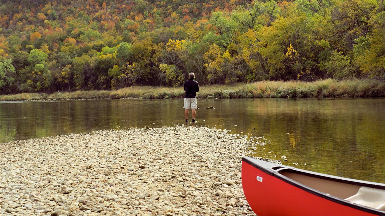
Palo Pinto County, the location for this trip down our longest and most storied river, is sparsely populated ranchland at the northern edge of the Edwards Plateau, so the boosters’ designation of this area as “Scenic North Texas Hill Country” is accurate. Especially along the river, which has cut deep valleys into the rolling topography. Grass tussocks cover the frequent sandbanks, and behind them steep, thickly-wooded slopes complete the air of rustic isolation. No wonder John Graves felt the need to eulogize this stretch of the Brazos in his 1960 classic, Goodbye to a River. Graves set out to document the history and geography of a section of the river that was about to be lost to a series of dams. But due in part to the book’s success, only one of the proposed dams was built. (In 2005 this section of the river was designated the John Graves Scenic Riverway.)
Between Highway 16 and FM 4 the river etches a sprawling, voluptuous W around Fortune Bend and Chick Bend. Floating along these long curves, you don’t have to close your eyes and imagine what it would have looked like to Graves, as little has changed over the past half century. These are the same cedar-and mesquite-covered hills that he glided through and the same wide, slow river that he ran. Although there are a couple minor rapids in this section, overall it’s an easy stretch of river to paddle if it’s not too windy. If you can’t make the trip soon, give it a miss until fall, when the valley turns red and orange. In the summer, low water and a lack of shade can seriously dampen the fun.
To cap off your trip, immerse yourself in a different aspect of local history by staying at the Double J Hacienda & Art Ranch, near the former health resort town of Mineral Wells. This eccentric-looking building, which stands high on the cliffs above Bath Bend, was designed in the late thirties by the Dallas architect Charles Dilbeck for sharpshooting oil scion Elmer Seybold. In the forties and fifties it was a dude ranch where movie stars—John Wayne, Bette Davis, and Ronald Reagan among them—came to play. By the sixties the area had gone into decline, and the ranch languished until 2004, when an advertising executive and country singer named Jimmy Baldwin and his wife, Jane, began to restore it. The main room, running the length of the western end of the building, features Seybold’s original fittings and furniture and does triple duty as a concert venue, kitchen, and cozy lounge. Outside, overlooking the river, is a veranda that manager Jack Kinslow calls “the front porch of the West.” Even in the height of summer, this place is cool.
Colorado River
Difficulty: Easy
Section Lady Bird Lake, MoPac (Loop 1) to Red Bud Isle, Austin
Difficulty Easy
Length and duration 4 miles, 1–3 hours
Resources Rowing lessons and boat rental from the Rowing Dock, 512-459-0999, and Texas Rowing Center, 512-467-7799
Reward yourself Grab coffee and tacos at the downtown Whole Foods.
Canoeing/Kayaking, Kid-Friendly
Yes, it’s called Lady Bird Lake. But let’s not forget that this lovely stretch of water that bisects Austin is part of “one sweet Colorado,” to quote Jimmie Dale Gilmore. Through happy accident or visionary town planning, the north bank of the river between the MoPac pedestrian bridge and Tom Miller Dam is almost free of development, and on the other side tall, cedar-topped cliffs obscure the mansions of Rollingwood. Paddling around while avoiding the ill-tempered swans is a fun thing to do with the kids on a sunny weekend afternoon (you can rent single, double, and triple kayaks; paddleboats; and even paddleboards). Remember to take plenty of sunscreen, as the only shade is in the shadow of the bluffs or under MoPac. In the summer it’s lovely to get out on the river before breakfast, though it will take more than an hour to get to Red Bud Isle and back. Better still, perhaps, is to take rowing classes and become one of those people whose measured movements send their delicate craft skimming ever so gracefully over the bright dancing waves.
South Llano River
Difficulty: Easy
Section South Llano River State Park to Schreiner Park, Junction
Difficulty Easy
Length and duration 5 miles, 2–3 hours
Resources South Llano River Canoes and Kayaks, 325-446-2220
Reward yourself Don’t miss the chicken-fried steak at Isaacks, in Junction.
Canoeing/Kayaking, Tubing, Kid-Friendly, Overnight Camping
Before the south llano meets the North Llano at Junction it passes through a wide picturesque valley. Fields full of crops and cattle line the western riverbank, while steep limestone hills typical of the Hill Country shelter this pastoral scene from the east. Roughly three miles from town as the crow flies, the river veers across the valley floor and through the pecan-forested bottomlands that are the special feature of South Llano River State Park. In the winter, flocks of wild turkeys live in these woods; in the summer, humans flock to the river, which offers lots of options. Little children can play safely in the shallows below the bridge close to the park entrance; bigger kids can rent tubes to use on the two and half miles of river inside the park’s boundary. Graduates of this training can paddle the five miles to Junction and ask Mom or Dad to meet them at the take-out and shuttle everyone to Isaacks for lunch.
Medina River
FM 2107, 5 miles west of Texas Highway 16, near Kerrville
Guadalupe River
Nichol’s Landing Paddling Trail, Nichol’s Landing to FM 311, near Bulverde
Section Nichol’s Landing Paddling Trail, Nichol’s Landing to FM 311, near Bulverde
Difficulty Moderate
Length and duration 5.4 miles, 2–4 hours
Resources Boat and tube rental and shuttle from Guadalupe Canoe Livery, 830-885-4671
Reward yourself Have a slice of the 46th Street Special pizza at 46th Street Pizzeria, in Bulverde.
Canoeing/Kayaking, Tubing, Rapids, Kid-Friendly
I don’t think I’ve ever been quite so happy as when I first floated down the Guadalupe River. Not just to be living in Texas but to find that so much of it is a paradise of green hills and cool water and nothing like the mental image I formed watching westerns filmed in the dry Southwest. Of course, millions of people have made this discovery, and every Central Texan is eventually baptized in the Guadalupe’s waters. Whether you want to swim, kayak, fly-fish, or simply be part of the joyful throngs of tubers who crowd the river in the summertime, the Guadalupe is the place. Amazingly, this jewel of the Hill Country remains largely untarnished by its popularity. Most of the fun takes place between Canyon Lake and New Braunfels, but only a few miles north you can be far from the madding crowd and still less than an hour’s drive from San Antonio. The section between Nichol’s Landing and FM 311 is particularly gorgeous and has excellent access, though the climb up to the road at the take-out is pretty steep. The river moves past high limestone bluffs, through avenues of bald cypress, and over a number of rapids that can be quite a thrill if the river is running well (at least 500 cubic feet per second, though it can be run at as low as 150 cfs). Fishermen can expect to find all kinds of bass as well as crappie, catfish, and sunfish. If you wish, you can extend your trip another 4.5 miles to Rebecca Creek Road. But don’t bother going below that, and be careful not to be swept into the low bridge, the nemesis of many a canoe.
Navasota River
Fort Parker State Park to Confederate Reunion Grounds State Historic Site, near Mexia
Section Fort Parker State Park to Confederate Reunion Grounds State Historic Site, near Mexia
Difficulty Easy
Length and duration 5 miles, 2–4 hours
Resources None
Reward yourself Take a seat at Jim’s Krispy Fried Chicken, in Mexia.
Fort Parker state park, just south of Mexia, is perfect for a lazy family weekend. Campsites along the shore of Fort Parker Lake—which is simply one end of the Limestone Bluffs Paddling Trail—boast great views of the sun setting over the park’s fishing pier, and there’s also a boat dock and some short hiking and biking paths. Although you never entirely leave the hum of civilization behind, paddling this five-mile stretch of the Navasota feels like slipping off into another world. The surrounding farmland is mostly flat, but it doesn’t take much topography to be impressive from water level, and the main attraction is a series of cute limestone mini-bluffs. In fact this river seems to have a little bit of everything—juniper trees reminiscent of the Hill Country, tall pine trees as in East Texas, and the dense hardwood bottoms one would expect to find in these parts. Here’s a secret: This section of the Navasota isn’t just lazy, it’s practically asleep. So save the entrance fee to the state historic site and start your trip upriver from the park’s put-in point. The still water makes this safe for kids and a great place to relax while you wait for a catfish or bass to bite on your line. It’s a George Strait song come to life.
Llano River
RR 2389 (James River Crossing, known locally as Dos Rios) to Simonsville Road (Martin’s Crossing), near Mason

Section RR 2389 (James River Crossing, known locally as Dos Rios) to Simonsville Road (Martin’s Crossing), near Mason
Difficulty Moderate
Length and duration 6.5 miles, 2–4 hours
Best bet for parking Dos Rios
Resources Fishing guides Marcus Rodriguez and Johnny Quiroz, of Guides of Texas,
Reward yourself Try the homemade Mexican food at Santos Taqueria, in Mason.
Canoeing/Kayaking, Rapids, Overnight Camping
Want confirmation that Texas is the best place on earth to live? Then drift down this section of the Llano on a warm day when the river is running and the fish are biting. After you pass the few houses on the south bank at the beginning of the trip, you glide through broad views of open ranchland covered with the classic Hill Country mix of yucca, cactus, oak, and cedar. The sun sparkles on water that splashes over the boulders lying in the shallow rapids and glints off high red bluffs.
Geologically, this area is on the edge of the Llano Uplift, and the Paleozoic bedrock found here doesn’t shine with the pink of the Precambrian granite east of U.S. 87. But what you will see are thin, tightly packed layers of dark-red sandstone stacked into towering bluffs, unique to this section of the river. The most famous are the two-hundred-foot-high cliffs at the halfway point of the trip, where the river makes a 90-degree turn to the northeast. As recently as the seventies, a young outlaw couple hid from a local Texas Ranger in these bluffs, presumably unconcerned about adding “trespassing” to their rap sheet. If you’re not running from the law, the large sandbar on the other side of the river is one of the best camping or picnicking spots in Texas. Just remember that if you leave the sandbar or try to clamber up the cliffs you’ll be on private property.
Though there is a dam in Llano, it’s a simple barricade with no power-generating capacity; this truly is one of Texas’s wild rivers. Deer and feral hogs are plentiful, and bass and sunfish teem in the Llano’s spring-fed waters, making the river a popular fly-fishing destination, with the bonus of great sight-casting opportunities in the clear stream. Many fishing guides use big rubber rafts, but for solo trips a kayak or canoe is more maneuverable, and the river bottom, which is limestone bedrock alternating with pebbly gravel stretches, is solid enough for wading into promising areas. Photographers dream about the quality of the light reflected off the rippling water and the bright limestone, which is perfectly complemented by the arc of a peerless cast. Fly-fishing on the Llano is one of the best ways to surrender to the rugged and beautiful Hill Country.
Pecos River
Pandale to the boat ramp at U.S. 90, near Comstock

Section Pandale to the boat ramp at U.S. 90, near Comstock
Difficulty Hard
Length and duration About 60 miles, 5–7 days
Resources Emilio Hinojosa’s shuttle and towboat service, 830-317-0760
Guidebook The Lower Pecos River, by Louis F. Aulbach and Jack Richardson
Reward yourself Enjoy a Tecate and the delicious seafood at Las Playas, in Ciudad Acuña.
Canoeing/Kayaking, Rapids, Overnight Camping
All you crazy adventurers, you lovers of wild and secret places, your next mission awaits you. The Church of the Holy Pecos offers towering bluffs, deep pools full of huge catfish and carp, challenging rapids, and, rarest of all, almost complete isolation. The area between the Edwards Plateau and the Trans-Pecos mountains is an intimidating landscape of treeless ranches and dusty oil fields, dominated by rocky gray mesas. It is likely the least-visited area of Texas, since for outsiders there’s really nothing else here—the Pecos passes through, and that’s about it. On the water there are no trails or any of the little brown signs that shepherd you around a regular park. A trip down this river is one of the last real adventures you can have in this state.
Here’s how to do it. Pick up Emilio Hinojosa at his place by U.S. 90 in Comstock and drive 65 miles north to Pandale. If you thought there was nothing in Comstock, wait until you see Pandale (though you can get a few last-minute supplies at the general store, if it’s open). Load up your boat, wave goodbye to Emilio as he drives your truck back to his place, and push off into the current. About a week later, when you’ve arrived at the boat ramp at Highway 90 and walked half a mile up the hill to get a cell phone signal, you call Emilio and he shows up with your truck. If the Cowboys are playing, he might invite you to watch the game on the big-screen TV in his party garden, where the locals will be working on a 24-pack of Keystone Light. In between Emilio sightings you’re on your own. The Pecos is a classic spring-fed pool-and-drop river, which means that calmer, wider sections alternate with short, fierce rapids hidden in thick canebrakes. The guidebook is only useful if you’re paying close attention, since it quickly becomes hard to tell one rocky bend from another. But one of the great joys of this trip is not knowing where you are and how much longer you have to go. Instead of worrying about the where and when, feast your eyes on the cliffs that my companion called a rock symphony, float through vast boulder gardens, and spend the evenings counting endless stars.
There are a few landmarks along the way. At about seventeen miles, you’ll come to the Flutes, several miles of shallow water passing over grooved limestone bedrock. You’ll have to jump in and out of your canoe and drag it from one tapering rut to the other, trying to find the best route. Fifteen miles from the end of the Flutes, try to spot the petroglyph-covered bluff in Lewis Canyon, famous for its enigmatic, abstract designs. Lewis Canyon Rapid, which comes up a few minutes later, is the first in a six-mile series of potentially class III (or even IV) rapids. The last of these, Painted Canyon Rapid, will almost certainly require a long portage. The Weir Dam, located at about the 46-mile mark, signals that you are heading into the last part of your journey. (At this point you will hear trains and imagine that you have reached the end of the trip. But the river takes another big curve north; you still have about fifteen miles to go.) Soon after, the canyon walls rear up and close in on the river, and you travel through a breathtaking cathedral of rock.
At a certain point the water loses its sparkle and the cliffs retreat into totalitarian aloofness; you have made it to Amistad Reservoir. The scenery is gorgeous, but the last ten miles are infamous for thirty-mile-per-hour headwinds and blistering heat. My advice is to ditch any macho delusions and prearrange (through Emilio) for a towboat. Perhaps he’ll bring a few of those Keystone Lights.
Neches River
U.S. 69 to Recreational Road 255, near Woodville
Section U.S. 69 to Recreational Road 255, near Woodville
Difficulty Moderate
Length and duration 18.5 miles, 2 days
Best bet for parking Recreational Road 255
Resources None
Guidebook Neches River User Guide, by Gina Donovan, Stephen D. Lange, and Adrian F. Van Dellen
Reward yourself Chow down on the catfish at Elijah’s Cafe, in Woodville.
Canoeing/Kayaking, Rapids, Overnight Camping
Between Lake Palestine and B. A. Steinhagen Lake, the Neches winds through dense hardwood bottomlands and deep pine forests, with sandbanks that gleam bone white in the sunshine. (Indian tribes called it the Snow River.) On the slow, dark water, hidden by steep banks and overhanging branches, I felt as though I was drifting through a sun-dappled dream.
This part of Texas is rich with history. Early Anglo settlers disappeared into the thick woods and thrived on the abundance they found there, and for a while specially modified flat-bottomed steamboats carried the pelts and honey these pioneers produced to Beaumont, from where they eventually found their way to Galveston and New Orleans. But the timber industry soon jammed the river with thousands of felled logs, crowding the waterway. Although no longer virgin, the forests have grown back and boast as great a variety of trees—hornbeam, water oak, ash, possum haw, maple, cypress—as any ecosystem in the country.
The best examples of those fairy-tale bottomlands are in the northern section between U.S. 84 and Texas Highway 294, but that is remote country, and the traveler can encounter a constant series of logjams, making progress extremely difficult. (Serious Neches river rats carry a saw.) Your best bet is a relaxing two-day trip between U.S. 69 and Recreational Road 255, just north of Woodville. The put-in is a little tricky, but the river here is wide and smooth, the water is that rich East Texas tea brown, and the high, sandy banks are topped with tall longleaf, loblolly pines, and thick brush. Immediately on your left is the Upland Island Wilderness Area, part of the Angelina National Forest, which is broken up by swaths of palmetto swamp and sandy, yucca-dotted tracts. Two miles in, you will come across the Neches’s only natural waterfalls, Rocky Shoals, which can be a mere two feet high in low-water conditions. Below that, numerous creeks flow into the river as it moves eastward through woods that cry out to be explored. (Though be aware that, because of what are called inholdings, even when you are in the national forest, you may be on private property. This applies to a lot of the river frontage, so look for the little brown signs that signal you are on public land.) There are good sandbars for camping beginning at the halfway mark, or you could hike the quarter mile through the forest to camp at Bouton Lake. The take-out is on Rocky Creek, which joins the river from the right just before the 255 bridge. Be careful, though: If you leave your boat anywhere, lock it up. My paddling partner hid his canoe when we left to get his car and returned just in time to give chase to an old woman who had dragged it out from deep in the bushes and was driving off with it perched on her roof.
In retrospect, it’s kind of funny when Granny tries to make off with your boat. But it’s not so funny when progress, for want of a better word, steals your river. In 2006 the U.S. Fish and Wildlife Service established the Neches River National Wildlife Refuge, which protects much of the area from development. But Texas could still create a reservoir site near the town of Rockland, which would flood a part of the section of the river described above. To protect the Neches for future generations, Congress would have to designate it a National Wild and Scenic River. If you want to get involved, consider joining a group like the Texas Conservation Alliance, which is working toward this goal.
San Antonio River
The San Antonio River Walk

Section The San Antonio River Walk
Difficulty Effortless
Length and duration 2.5 miles, 35 minutes
Resources Rio San Antonio Cruises
Reward yourself Savor the enchiladas and margaritas at Casa Rio, the first restaurant built on the River Walk.
Kid-Friendly
There’s no place else in the world like San Antonio, a city where the strata of history, from the missions to the Alamodome, butt up against one another at odd angles like objects in a Picasso. Think of the River Walk as the thread that holds it all together. Tourists and natives mingle along its tree-lined concrete walkways far below the fantastical jumble of the downtown skyline, eyeing the array of Texas culinary culture on offer. Better still is the river cruise; your guide’s narration will make some sense of this weird mix of edifices. You’ll learn how the River Walk was created, what was removed to make way for it, and everything you’d want to know about the buildings—and even the trees—to be found along the way.
Rio Grande
Rancherias to Lajitas, through Colorado Canyon
Section Rancherias to Lajitas, through Colorado Canyon
Difficulty Hard
Length and duration 24 miles, 6–9 hours
Resources Shuttle and guide service from Big Bend River Tours, 432-371-3033
Reward yourself Polish off a bowl of chili at the Starlight Theatre, in Terlingua.
Canoeing/Kayaking, Rapids, Overnight Camping
So much has been written about the Rio Grande that I feel justified in being brief here. Impounded, channelized, and pumped dry, the river gives up the ghost in the desert at Fort Quitman and is resuscitated at Presidio by the Rio Conchos. Last year Mexico released enough water from Luis León Reservoir for the rafting to be consistently good, and in late February there was ten feet of water in the Rio Grande at Lajitas. When the river is that high, most tourists want to raft through Santa Elena Canyon. But this is your opportunity to make like the locals and brave the rapids in Big Bend Ranch State Park that stretch from Rancherias to Lajitas. That’s usually done as an overnight trip, but if you’re feeling ambitious and the water’s running fast, you can pull it off in a day. If the river is just too low, you might try the shorter version that passes through Colorado Canyon and ends in Madera Canyon. Unlike the light limestone of the lower canyons, the rock walls here are red, black, and gray igneous rock, arranged in twisted layers like tortured toffee.
Devils River
Baker’s Crossing, Texas Highway 163 to Blue Sage subdivision, near Del Rio
Section Baker’s Crossing, Texas Highway 163 to Blue Sage subdivision, near Del Rio
Difficulty Hard
Length and duration 23 miles, 2–3 days
Resources Gerald Bailey’s shuttle and guide service, Devils River Outfitters, 830-395-2266.
Camping at Devils River State Natural Area, 830-395-2133 (reservations required; 512-389-8900)
Guidebook The Devils River, by Louis F. Aulbach
Reward yourself Get a good night’s sleep at the low-key Who Cares B&B, in Del Rio.
Canoeing/Kayaking, Rapids, Overnight Camping
If the Devils River were a woman, Willie would have married her twice and we would be crying into our beer as he lamented her wicked ways. You might be tempted to dismiss it as the Pecos lite, but the Devils packs a bigger punch into less than one hundred miles. It’s another pool-and-drop river that runs through rugged terrain similar to the Pecos, but the thirty miles or so that separates these two makes for noticeable differences in topography and vegetation. The gray-blue water is more blue than gray (the remote, hostile environment has successfully safeguarded the pristine water quality), the rocky hills are a little greener, and the banks are lined with trees. Though the dam on the Rio Grande that created Amistad Reservoir backs up the flow in the Devils’ lower reaches, this is the one river in Texas that’s never been dammed itself, and every blade of grass and snatch of birdsong resonates with unfettered exuberance.
But boy, getting down the Devils is hard work. They call it a “wet” river, which means that you’ll be in and out of your boat as you pull it through endless shallows and down rapids, all the time hanging on to that webbing for dear life while yelling at your partner. (Think twice before taking your significant other. The Devils is a jealous river.) The rapids are fast and pugnacious and come up on you quickly, so expect to simultaneously try to find the best line of approach and the right channel through the dense canebrakes before you are swept into a rock wall. If you go the wrong way, you can be lost in the cane jungles for half an hour. (We’re having fun, right?) In addition, the landowners along the Devils have a reputation for antipathy to boaters, so the first safe and legal campsite is at the Devils River State Natural Area, fifteen miles from Baker’s Crossing, which makes for a long day’s paddling.
Is it worth it? Yes, a hundred times yes, and the bonus is that you get to see the Devils’ great secret, the grand Dolan Falls, which is half a mile or so below the state park. Pay attention on your approach, as the drop is ten to fifteen feet into strong currents. Portage river right and lower your boat back into the water from the rocks. Before you leave, make sure you take your picture in front of the largest continuously flowing waterfall in Texas. Three miles later you’ll come to the last major hazard, Three-Tier Falls, which has a nasty blind entrance—stop and scout your line carefully. From there it’s only four miles to the take-out, which you’ll recognize by the rust-colored, gray-striped roof of shuttle operator Gerald Bailey’s house, one of several in this 1970’s-vintage subdivision. (If it’s not too windy, Bailey may also fly his large pirate flag.) The development is a surprising sight after a couple of days of seeing only five or six houses. As much as I would like to be able to afford a home here, I’m glad that the Nature Conservancy is working with local ranchers to protect the watershed, including nearly 150,000 acres in the Devils River basin. A river this beautiful needs proper care and attention.
Blanco River
Pleasant Valley Crossing (Fischer Store Road) to Wayside Drive (County Road 179), Wimberley
Section Pleasant Valley Crossing (Fischer Store Road) to Wayside Drive (County Road 179), Wimberley
Difficulty Moderate
Length and duration 9.5 miles, 3–5 hours
Best bet for parking The river crossings between Fischer Store Road and RR 12 are the most popular section, but spots are limited. There is some space under the bridge at the put-in, though bribing a spouse or friend to wander the shops of Wimberley while you paddle is probably the best idea.
Resources None
Reward yourself Stop in at the Leaning Pear, in Wimberley, for a gourmet sandwich.
Canoeing/Kayaking, Rapids
Two factors make running the Blanco a challenge. The first is that at normal levels it’s too shallow to navigate, so you can go down it only under flood conditions, which is fun but somewhat dangerous (and even then there are big boulders and rock gardens to navigate, as well as one low-water crossing, at G. W. Haschke Lane, about two miles from the start). The second is that while access is not difficult, parking is scarce. But the river is worth the hassle. The Hill Country around Wimberley features sharp hills and steep valleys, including the Devil’s Backbone, off to the south, and I am always surprised by how wild and beautiful this area is. Although there are plenty of gorgeous houses along the river, they pale before the stunning scenery. Watch for the huge limestone stairs covered with cedar and oak. Next time there’s a big rainstorm, go online and check the water flow at Wimberley. If it’s over 250 cubic feet per second, call in sick and head for the Hill Country.
San Marcos River
U.S. 90 to Zedler Mill, Luling
Section U.S. 90 to Zedler Mill, Luling
Difficulty Easy
Length and duration 6 miles, 2 to 4 hours
Resources Boat rental and shuttle from the City of Luling, 512-227-1724; call at least a day before
Reward yourself Save room for the barbecue at City Market or Luling Bar-B-Q–or both
Luling’s location in the much-traveled Central Texas barbecue belt is enough to ensure the town a stream of visitors. If you want to feel virtuous, paddle down the San Marcos before you belly up to the brisket. It’s a wonderful day out for the family, since the meandering river is gentle but offers a few small riffles that will provide some excitement for novice boaters. Watch out for sunken logs and fallen trees, which rest in the river like sleeping monsters in a tangle of smaller deadwood. Cows stare down at you from their grassy pastures, and the air is sometimes thick with the smell of oil from backyard wells–Luling displays the pastoral side of the state’s two iconic industries. On April 24, the Zedler Mill, a nineteenth-century red-brick structure located on the river, plays host to the Zedler Mill Classic, offering canoe races and an arts and crafts fair. No barbecue though, just catfish.
San Marcos River
Aquarena Center, Spring Lake, San Marcos
Section Aquarena Center, Spring Lake, San Marcos
Difficulty Easy
Length and duration Roughly 1 mile, 3 hours
Resources Aquarena Center, aquarena.txstate.edu, 512-245-7570
Reward yourself Tuck into a yummy sandwich from Alvin Ord’s, in San Marcos.
Kid-Friendly
Aquarena Springs has come a long way since the days of the underwater shows that featured Glurpo the clown and Ralph the swimming pig. In 1996 the old theme park was taken over by Texas State University. Refashioned as the Aquarena Center, it now offers enlightening guided tours of the second-largest artesian springs in the Southwest. Through the glass floor of your kayak or motorboat you can see the sandy bottom of the lake whirl and bubble as about 150 million gallons of water a day are squeezed out of the Edwards Aquifer. (Research suggests that some of this water has been stored so long it carries radioactive isotopes from aboveground nuclear testing.) These springs, which have never gone dry, not even during the worst drought, have been the cradle of life in Central Texas for eons. The River Systems Institute, which runs the center, has done a wonderful job of restoring the lake to as natural a state as possible, and teams of volunteer divers spend countless hours tending to this underwater garden. The institute, which is leading the development of environmentally sustainable public water policy in Texas, is almost entirely dependent on contributions. If you’re feeling generous, a modest donation of $5 million would put it on a firm financial footing—and also help replace the center’s aging glass-bottom boats.
Buffalo Bayou
Difficulty: Easy
Section Memorial Park, by Woodway Drive, to Hogg Bird Sanctuary, Houston
Difficulty Easy
Length and duration 3 miles, 1–3 hours
Resources Tours by Buffalo Bayou Partnership, buffalobayou.org
Reward yourself Order the spinach-artichoke turkey burger at Shandy’s Café, on Memorial Drive, in Houston.
Canoeing/Kayaking, Kid-Friendly
Although Houston’s Buffalo Bayou, which passes right through the center of the city, isn’t strictly a river, it’s great fun to drift down. The Buffalo Bayou Partnership has worked hard to transform this once poisoned channel into a beautiful riparian corridor. Twenty-six miles, from Texas Highway 6 to just east of downtown, have been designated one of the state’s eighteen paddling trails. Volunteers have pulled out invasive species and planted native flora along the banks, creating a better habitat for wildlife. Passing through the thick piney woods of Memorial Park you’ll find yourself worlds away from the nearby crowded freeways and malls. Unusual for this part of Texas, there are oak and hickory trees, as well as the pine, elder, and willow you would expect. Coming up on May 1: the tenth annual Dragon Boat Festival, featuring the decorous forty-foot racing vessels.
Frio River
Difficulty: Easy
Section Third Crossing to Texas Highway 127, Concan
Difficulty Easy
Length and duration 4 miles, 2 hours
Resources Kayak rental and shuttle from Andy’s on River Road, 830-232-5444.
Camping at Andy’s and Buchanan Cabins, 830-988-3272
Reward yourself Bite into a Swiss-mushroom chicken sandwich at Neal’s Dining Room, in Concan.
Canoeing/Kayaking, Tubing, Rapids, Kid-Friendly, Overnight Camping
Pure, cold water, a limestone-and-gravel bed, cypress trees, and chutelike rapids make this part of the Rio Frio big fun. The long, narrow channels are overhung with dense vegetation, meaning that for much of the time, I couldn’t see very far ahead; the effect was that of a natural water park. This stretch of the river is both safe and exciting, a great place to introduce kids to Texas rivers—especially because once you get off the river there’s plenty to do. The take-out is at the bridge at Highway 127, near Buchanan Cabins’ property, which boasts a wide beach by one of the prettiest swimming holes in Texas and lots of large boulders to jump off. Four dollars gets you in here for the day; $10 gets you an umbrella, a table, and two chairs; and as little as $82 lets you and some friends spend the night in a cabin. Happiness included.
Canadian River
Difficulty: Effortless
Section North River Road, U.S. 83 to Texas Highway 70, near Canadian
Difficulty Effortless
Length and duration 22 miles of driving, 1 hour minimum
Resources None
Reward yourself Fill up on the steak and fries and famous bread pudding at the Cattle Exchange, in Canadian.
Kid-Friendly
The Canadian is usually too dry to be much good for floating, but it supports a host of other sports. The duck hunting is great, and ATV riders roar around the designated areas at Lake Meredith, a bit north of Amarillo, where there are plentiful off-road trails crisscrossing the sandy riverbed. But you don’t have to get off-road to enjoy the spectacular scenery along the Canadian. Just drive this 22-mile stretch of ranch road that follows the northern bank of the river through Hemphill and Roberts counties, which have fewer than three people per square mile. That’s a lot of empty rolling grassland and limestone mesa, and, as might be expected, the bird-watching is world-class. Members of the Panhandle Bird Club come here to see eastern birds such as red-bellied woodpeckers and barred owls; in winter you might see Harris’s or American Tree sparrows.
San Antonio River
Section: U.S. 59 to Goliad State Park and Historic Site, Goliad
Section U.S. 59 to Goliad State Park and Historic Site, Goliad
Difficulty Easy
Length and duration 6.6 miles, 2–4 hours
Resources None
Reward yourself Throw back a pint at Ervie Jay’s Beer Garden, where Goliad’s mayor provides the musical entertainment some evenings.
Canoeing/Kayaking, Tubing, Overnight Camping
From Texarkana to Laredo the eastern swath of the state consists of soft earth. At Goliad, on the edge of the Gulf Coast prairies, the San Antonio River has cut a deep channel into the sandy, oak-covered plain. Plants and animals thrive in the mild South Texas climate, and the lush woodlands along the river support a large variety of birdlife, including the herons, hawks, and kingfishers that are a common sight on most of our waterways. There are no dams on the lower San Antonio, so a heavy rain can quickly create flood conditions. When I was there, the current was strong from recent storms, but by no means unmanageable. Access, on the other hand, is a little difficult on this stretch. Both the U.S. 59 and Ferry Street put-ins have steep, narrow concrete steps that are hard to navigate when carrying a boat, and there’s no shuttle service, so you really need at least two people and two vehicles to make this trip work. (The San Antonio River Authority plans to improve these facilities.) Goliad itself, with its missions and charming downtown area, is a big part of the reason to make the journey south. Mark your calendars for the Canoe Trail Goliad Summer Flotilla, on June 5.


