


God love her, Peggy Bayless got a lot of it wrong. So did many of the people who taught Texas history to our seventh-graders over the generations. Miss Bayless’s shortcomings were exposed recently during a three-month odyssey in which I visited battlegrounds all over the state. Time and again I learned about signal events that she had never mentioned and that I had never dreamed occurred. The trip covered more than a thousand miles and took me from the upper reaches of the Panhandle to the southernmost tip of the coast. The journey was an eye-opener, history exposed to the glare of fresh research and firsthand exploration.
I learned, for example, that the Texas Revolution—the original one at least—began not in 1835, as I was taught in the Arlington public school system by the learned Miss Bayless, but in 1812. That was the year the Republican Army of the North swept across the Sabine and later captured Nacogdoches, Goliad, and San Antonio from the royalist government of Spain before declaring independence on April 6, 1813. As Frank de la Teja, the chair of the history department at Texas State University, in San Marcos, has pointed out, when we celebrate Texas Independence Day, we should remember April 6, 1813, as well as March 2, 1836.
The Republican Army of the North was a ragtag band of Mexicans, Tejanos, Anglos, and American Indians commanded by José Bernardo Gutiérrez de Lara, a native of the Rio Grande town of Revilla, and Augustus Magee, a former U.S. Army lieutenant. Gutiérrez was a patriot, Magee an adventurer. Their invasion of Texas from the no-man’s-land along the Louisiana border was the first step in a grander plan to free all of Mexico from the hated Spanish government. It resulted in the short-lived Green Flag Republic of Texas, so called because of the color of its battle flag.
That’s right, Miss Bayless, more than six flags flew over Texas. In fact, as I learned during my reporting, the correct number is closer to nine. There’s also a red-and-white banner that James Long and his filibusters flew when they occupied Presidio La Bahía, at Goliad, in 1821, and a flag with a red severed arm and a bloody sword that flew over the fortress a few months before the Texas Declaration of Independence (the one in 1836, that is).
My great adventure was conceived last summer on a visit to San Antonio when, in one of those eureka moments, it dawned on me that we’ve always treated battlefields as shrines rather than historical sites. We’ve forgotten why they are important, how they are interconnected, and how they shape our destiny. We protect the Alamo’s two remaining original structures, the chapel and long barracks, as if they were irreplaceable jewels, but we mostly ignore Alamo Plaza, where much of the fighting took place. The plaza has been allowed to degenerate into a commercial mess: The west wall, which was once William B. Travis’s headquarters, is now occupied by Ripley’s Believe It or Not; the north wall, where he died, is a post office.
So after consulting with several prominent historians and writers, I put together a highly subjective list of battlegrounds that had a special appeal to me and hit the road. I learned that some of our most interesting and important sites are sadly overlooked, a tragedy given the ferocious birth of our state. In so many ways, our history is written in the blood of the men and women—Spanish, Indian, Mexican, and Anglo—whose lives ended in violence. We’ve made almost no effort to understand these battles or tell people how to find their locations. Small wonder they are largely forgotten. I made it my mission to remember.
The Massacre at the San Sabá Mission
Location: Near Menard
Date: March 16, 1758
Casualties: More than 25 killed
The only help I had in finding the site of the massacre at the San Sabá Mission were a few books written by Robert S. Weddle, an independent historian from Bonham. Weddle spent years researching not only the attack on the mission along the San Saba River by an alliance of the Comanche and other tribes but also the ill-fated expedition that sought revenge. After several false starts, I located a marker next to a plowed field on Ranch Road 2092, just east of the bucolic Hill Country town of Menard. Archaeologists didn’t discover the actual site until 1993. For years people confused the mission with the presidio, which was built 4 miles upstream, or mistakenly believed it was 75 miles away, in the town of San Saba. As I would soon discover, this battle had been a massacre waiting to happen.
The ruins of the presidio were easier to find. They sit next to the Menard Golf Course. The fortress was imposing, but today all that remains are a few broken walls and a tower, which were reconstructed in 1937—the “ruin of the ruins,” as Weddle put it. Golfers on the adjacent course appeared not to notice or care what happened here more than 250 years ago.
As massacres go, the body count at the mission was fairly modest. A mounted horde of two thousand Comanche and their allies burned the mission on March 16, 1758, killing two priests and six other Spaniards. Spain had built this mission to help pacify the Apache, never dreaming that the Comanche were a more serious problem. The Apache had been driven down the Edwards Plateau by the Comanche and had started terrorizing settlers. Something had to be done. The military advocated killing as many Indians as possible, but the clergy thought it had a better idea: Convert them.
For a while the Apache appeared to go along with the “brown robes,” but in fact they never intended to trade their freedom for the life of a Christian sodbuster. Squeezed from the south by the Spanish and from the north by the Comanche, the cunning Apache played their two enemies against each other. The Spanish never realized that they had been tricked into building the mission on the edge of Comancheria; the Comanche knew exactly how to respond.
Before the attack began, the priests were so bewildered at the sight of the warriors that they ordered the soldiers to hold their fire. In his classic book Lone Star, T. R. Fehrenbach wrote that Padre Terreros “seemed hypnotized by the barbaric splendor of the savages, who were painted black and red—war paint, though the Spanish did not recognize it—and wore impressive headgear of buffalo horns, deer antlers, and eagle plumes.”
Rummaging through the ruins one chilly day last November, I got the eerie feeling that the ghosts of the Spanish soldiers were still around. I sat for a while on the banks of the placid, green San Saba, sheltered from the low autumn sun by giant oaks and pecans, reflecting on how a people as ingenious as the Spanish could have been subverted by their own arrogance. In downtown Menard, you can still see their system of canals. But these same deep thinkers practiced a suicidal policy of trying to match the Indians killing for killing, cruelty for cruelty. Priests signed off on the slaughter by giving soldiers absolution in advance. When Spaniards killed Indians, it was God’s work. When Indians killed Spaniards, it was a massacre. No wonder, then, that the Spanish began losing their missionary impulses after their experience on the San Saba.
The Parrilla Campaign
Location: The Red River, near Spanish Fort
Date: 1759
Casualties: More than 100 killed
The expedition to avenge the attack on the San Sabá Mission was the grandest ever mounted by the Spanish in colonial Texas. Commanded by Colonel Diego Ortiz Parrilla, six hundred men, plus seven hundred or so Apache, who had tagged along mostly to hunt buffalo and make mischief, set out to reassert Spain’s dominance. But Parrilla, who had survived the attack at the mission, had no idea where he was heading. This was uncharted territory, up the Edwards Plateau to the Rolling Plains, then along the edge of the Cross Timbers to the Red River.
Weddle estimates that Parrilla traveled more than four hundred miles to reach the Red River, meandering along the way. At one point the soldiers diverted from their route to attack a Tonkawa village. Though the Tonkawa were most likely not part of the war party that had burned the San Sabá Mission, the Spanish nevertheless killed 55 Indians and took away 149 prisoners in chains.
The trail eventually led to a newly fortified village occupied by the Comanche and the Taovaya, a branch of the Wichita. The fortress was surrounded by a moat and sat on a high riverbank in what is now Jefferson County, Oklahoma. Directly across the river, on the Texas side, are Montague County and a tiny community named Spanish Fort.
I parked my car in the middle of a street that looked as though it hadn’t been used for years and wandered around, braving a cold north wind. There were a few homes scattered about but hardly any signs of life. The shutters of an abandoned general store rattled in the wind. Walking through snarled undergrowth toward the steep bank of the river, I could appreciate Parrilla’s position. As the horses of the Spanish cavalry stumbled and became mired in sand, Indian marksmen poured heavy fire from their elevated fortress. At the same time, mounted warriors crossed the river and flanked the Spaniards on both sides. After about four hours, Parrilla retreated, but in his haste he left behind two cannons and some supplies. It was Spain’s worst military defeat in Texas.
Today a small park sits in the center of Spanish Fort, with two historical markers. A granite one from 1936—the year of the centennial, when monuments went up across the state—mistakenly claims that this was the site of “an ancient Taovayas Indian village.” The other marker is also incorrect. It explains that the Indian fortress flew a French flag and was manned by fourteen French soldiers. This mistake was apparently gathered from Parrilla’s report, written after the battle. The Taovaya may indeed have flown a French flag; the French were a trading partner. But there were almost certainly no French soldiers at the battle, let alone the six thousand warriors that Parrilla had later claimed. His exaggerations were no doubt an attempt to shine the best possible light on his defeat. “It was one thing to be beaten by other Europeans,” Fehrenbach wrote, “but quite another to be routed by savages.”
The Battle of Medina
Location: South of San Antonio
Date: August 18, 1813
Casualties: More than 1,000 killed
The bloodiest battle ever fought on Texas soil is one I’d never heard of. Waged near the Medina River south of San Antonio, the Battle of Medina spelled the end of Gutiérrez and Magee’s Green Flag Republic. But it also set the stage for Anglo-American settlement in the coming decade.
No one knows the exact location of the battle. But most historians agree that it is not the intersection of U.S. 281 and Farm-to-Market Road 2537 (also known as Martinez Losoya Road), where a granite marker sits in a patch of weeds on the grounds of San Antonio’s Southside High School. Vandals have chipped away the word “Medina” from the monument, but the text does mention the “terrific slaughter” and concludes, “Thus ended an attempt to free Texas and Mexico from Spanish rule.”
“No, no, it was not the end,” said my companion, a 61-year-old realtor from Austin named Dan Arellano. “It was actually the beginning.” Short and compact, with silver hair brushed back and a neatly trimmed silver mustache, Arellano spent his free time researching and writing about the Spanish and Mexican colonial history of Texas and looking for the true site of the battle: His great-great-great-great-grandfather Francisco Arellano fought there on the side of the royalists. Sergeant Arellano was a Tlaxcalan Indian from the village of Álamo de Parras who had been conscripted into the royalist army. “Most of the Spanish soldiers were Indians,” Arellano told me. “Put a uniform on them, and they became Mexican.”
Arellano believes that the actual location of the battle is about five miles south of the high school, in a pasture on the Toudouze Ranch. But before he took me to the ranch, he wanted to show me a nearby cemetery, next to Our Lady of Mount Carmel Catholic Church. A plaque at the edge of the grounds claims that hundreds of men from the Battle of Medina are buried there. “The number should be fifty-five,” Arellano said. “That’s how many Spanish royalist soldiers were killed. More than a thousand Republican soldiers were left to rot on the field.” One reason he believes the pasture on the Toudouze Ranch is the true location is its proximity to the lowest point on the river, called Losoya Crossing, just behind the cemetery. “The royalists crossed the river right here,” he said. Though other historians have placed the battle twelve miles to the south, Arellano disagrees. “The Spanish wouldn’t have carried their dead all that distance in the August heat,” Are-llano told me. “That’s why I think my location is the right one.
“I’ve done six digs, some of them legal,” Arellano joked as we continued south on U.S. 281, in the direction of Pleasanton. “I’m just an amateur with a metal detector.” Past Loop 1604, Arellano turned at the blinking yellow light, onto Rockport Road. On our left was the fence line of a section of the Toudouze Ranch that is owned by Chuck Toudouze. He is one of the few landowners who have given Are-llano access. In this pasture Are-llano and others have found old belt buckles, an emblem of rank worn on a hat, cooking items, and numerous musket balls, which were identified as the type belonging to the British-made Brown Bess musket issued to Spanish troops.
The land, with tall grass and groves of oaks and mesquite, hasn’t changed much in two hundred years. “Just imagine four thousand men out in that thicket of trees, shooting musket balls at each other,” Arellano said. We sat for a time, our backs against an ancient oak, looking out over pasture that slumbered silently under the weight of history, its secrets safe for the moment. In our minds we could hear the roar of field pieces and the screams of the dying. The battle was a slaughter. Reinforced by a unit just called up from Veracruz, the royalists were a superior fighting force, and their victory returned San Antonio to Spanish control. A bitter division among the leaders of the rebels had weakened their cause. At the conclusion of a previous battle in San Antonio, soldiers under the command of Gutiérrez had ignored the judgment of their Anglo comrades and massacred royalist prisoners. They’d cut out the tongue of the Spanish governor, then slit his throat.
Echoes of the battle still vibrating in my head, I listened as Arellano spun yet another tale of the breathtaking cruelty: “When the Spanish army returned to San Antonio,” he began, “they arrested three hundred twenty-seven men suspected of being loyal to the rebels and shot them, three each day. Then they beheaded them and placed their heads on spikes. They raped the women and kept them in prison. That’s why there is a street in downtown San Antonio called Dolorosa, meaning ‘pain.’”
The Battle of Coleto Creek
Location: Outside Goliad
Date: March 19—20, 1836
Casualties: Unknown
The Goliad Massacre
Location: Presidio La Bahía, Goliad
Date: March 27, 1836
Casualties: 342 killed
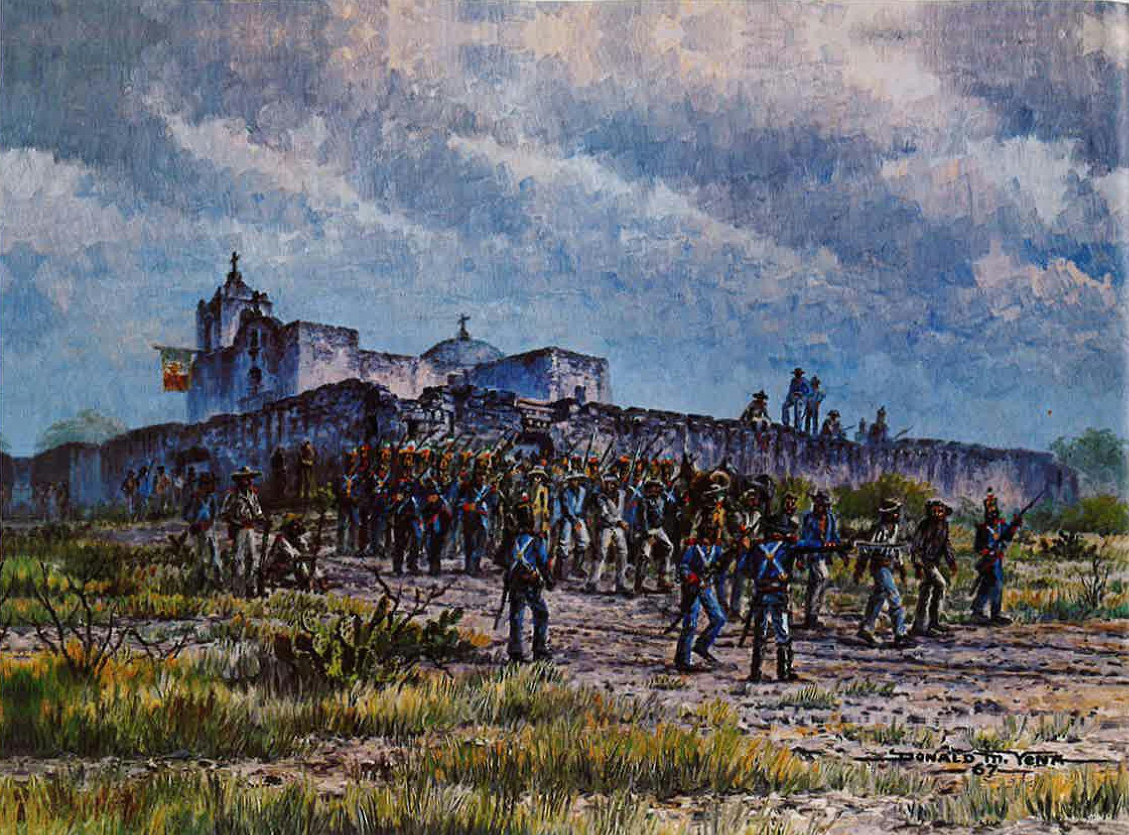
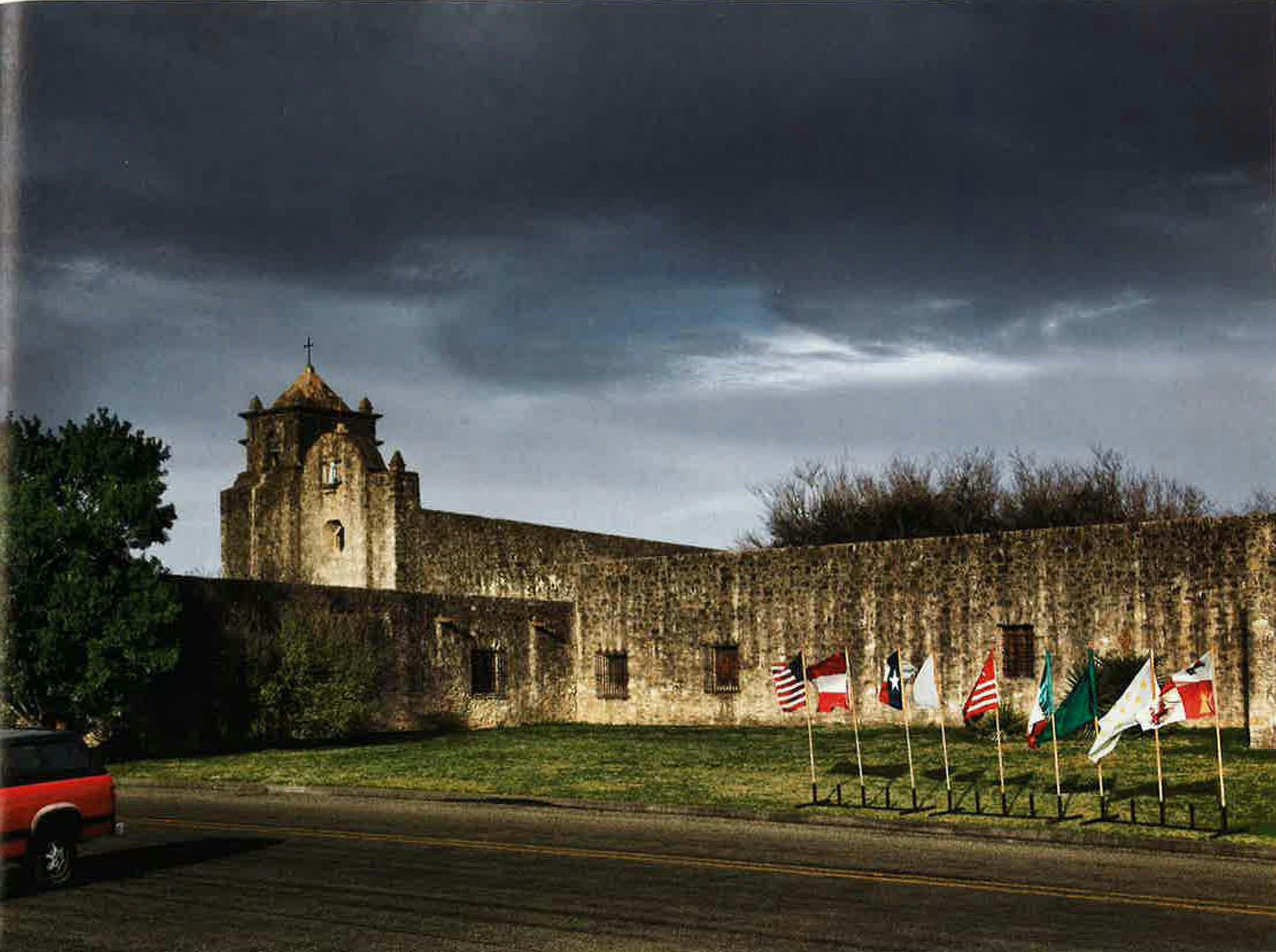
On my visit to Presidio la Bahía, in Goliad, I began connecting the dots linking Spanish colonial Texas to the revolution: It was then that I realized that the fight for independence started as a Mexican civil war. The handsome presidio on the south bank of the San Antonio presidio on the south bank of the San Antonio River isn’t just the soul of the Texas Revolution—it’s probably the most fought-over site in Texas.
Though the old fortress has been reconstructed, it is more imposing than the Alamo. This was the site of the Goliad Massacre, where Mexican soldiers, carrying out orders from Santa Anna, murdered James Fannin and 341 of his men on Palm Sunday, 1836. The atrocity furnished the second half of the battle cry used at San Jacinto: “Remember the Alamo! Remember Goliad!”
“The fort was the guardian of the Texas coast,” Newton Warzecha, the director of the presidio, told me. “During the revolution, it cut off the supply of goods from Copano Bay to Mexican troops in San Antonio.” Fannin made a number of strategic mistakes that led to the massacre, but perhaps the worst was not abandoning the presidio sooner. Sam Houston had ordered Fannin to join him near the present-day town of Columbus, yet Fannin hesitated until Mexican troops were on the outskirts of Goliad. As the Texan soldiers finally withdrew and headed for the protective timbers of Coleto Creek, on the road to Victoria, they were cut off by the Mexican cavalry and forced to defend themselves in an open field.
The Battle of Coleto Creek began on March 19 and lasted until the following morning, with both sides taking heavy fire. A cold rain blew in overnight, making Fannin’s position even more perilous. His men erected barricades out of carts and dead animals, but at dawn the Texans realized that the Mexicans had brought up reinforcements. Fannin knew that another stand would be futile. After consulting with his officers, he decided to seek an honorable surrender.
Prisoners were herded back to Goliad, their spirits buoyed by the belief that they were prisoners of war and would eventually be returned to the United States. Fannin hoped that would be the case, but he understood that they were at the mercy of Santa Anna, who had issued a “no quarter” policy toward the rebels.
Warzecha led me to the chapel, the only part of the original presidio still standing. “This is where they kept the men for the first two or three days,” he told me. They still had no idea of their fate.
Early on the morning of Palm Sunday, after a week of captivity, those who could walk were separated into three groups and told conflicting stories about their destination. “They marched them through this sally port, one group at a time,” Warzecha said. One was taken down the San Antonio road, another to the Victoria road, and a third to the Copano road. When they had gone about half a mile, the Mexican soldiers formed a line and opened fire at close range. Some of the Texans ran, and a few escaped by diving into the San Antonio River. The wife of a Mexican officer, known to history as the Angel of Goliad, saved a number of lives by pleading with another officer to spare whomever he could. After the killings, the soldiers returned to the fort and executed the wounded.
Fannin was the last to die. He was blindfolded and seated in a chair next to a gate. He made three requests: that he not be shot in the face, that his possessions be given to his family, and that he receive a Christian burial. Soldiers shot him in the face, took his goods, and dumped his body with all the others.
In 1938 the Fannin Memorial Monument was dedicated in a field just behind the presidio, and it bears the names of all the fallen Texans, from Wiley A. Abercrombie to Solomon Youngblood. Yet there are no markers at the three locations where the soldiers were killed. “We think we know where they are,” Warzecha told me, “but they’re all on private property.” The assumed site of the Coleto Creek battlefield is now the Fannin Battleground State Historic Site, off Texas Highway 59. As parks go, this one was sterile and uninteresting. I was there on a weekday, when there wasn’t another soul in sight. The information center, a white pavilion surrounded by picnic tables, was closed. I looked around for the creek but couldn’t find it. As a monument to history, I thought, this spot fell short, but it was a nice enough place for a picnic.
The Battle of San Jacinto
Location: La Porte
Date: April 21, 1836
Casualties: Approximately 640 killed
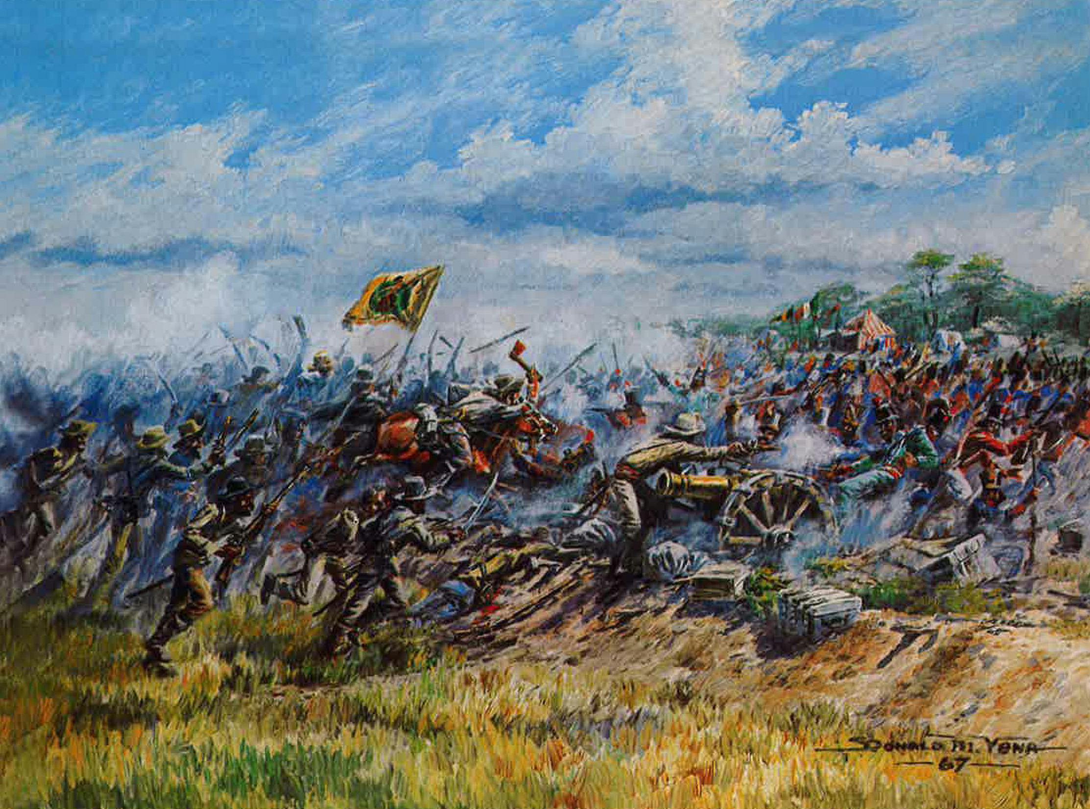
The triumph of Santa Anna’s army at the Battle of Coleto Creek and the deadly efficiency with which the Mexican dictator’s wishes were carried out at Goliad led him to believe he really was the Napoleon of the West, a military genius on the cusp of quelling an annoying little rebellion. At the Battle of San Jacinto, he learned how wrong he was.
Santa Anna led seven hundred Mexican troops toward Harrisburg to capture officials from the Texas government. But when he arrived, he found that everyone had fled to Galveston, so he burned the town and headed toward Lynchburg. Santa Anna considered Houston a rival of no consequence. He was wrong about that too.
Houston, on the other hand, seemed destined to lead a rebellion. A man of intrigue and daring, he was intemperate, grave, and absorbed in his own vision of Manifest Destiny. He had resigned under a cloud of scandal as the governor of Tennessee; lived for years with the Cherokee, who knew him as Big Drunk; and come to Texas, like other rowdies and misfits, seeking redemption. But by San Jacinto, his troops were close to mutiny: Many of them thought Houston gutless, more interested in retreating than fighting.
“San Jacinto was not so much a battle that Houston won but rather one that Santa Anna squandered,” explained Stephen L. Hardin, a professor at the Victoria College, who showed me around the battle site. A robust man with a silver beard, Hardin is the author of a history of the revolution titled Texian Iliad. He is firmly convinced that Houston is an overrated military leader, and he spent much of our afternoon together making his case.
We were sitting on a park bench on an elevated bank overlooking Buffalo Bayou, at the edge of what would have been the Texan camp on April 20, 1836. Just behind us were paved walkways, statues, and granite markers identifying sites where various units of Houston’s army camped. One marked the spot where Santa Anna surrendered to a wounded Houston. Off to our right, rising out of the marsh like a black hulk from hell, was the battleship Texas, which is berthed near where Juan Seguín’s men would have pitched their tents. Except for the misplaced battleship, the park seemed to be an attractive and friendly place to contemplate history, here among a thick grove of oaks that gave the Texan army an advantage over the Mexican cavalry. Hardin is a battlefield purist, however, and he was disgusted by the way the site had been turned into a patriotic shrine. “This isn’t a monument, though that’s what everyone calls it,” he fumed. “It’s a damn battleground!”
Directing my attention to the bayou, Hardin reminded me that the waterway was much narrower in 1836. “I think Houston was trying to find a way not to fight this battle,” Hardin told me. “I think it crossed his mind that he had time to build a bridge for his retreat across the bayou. United States Army units were stationed on the Sabine, and if Santa Anna got too close, they would move into Texas to defend U.S. sovereignty.”
“Wouldn’t that have changed the whole dynamics of the revolution?” I suggested.
“You’ve heard the expression ‘I’m a Texan first and an American second’?” Hardin replied. “Well, that applies to me. Houston, on the other hand, was an American first. If U.S. troops had entered the battle, Texas would have joined the Union immediately, and we never would have been a republic. Those ten years as a republic explain the exceptionalism that is the core of the Texas character.”
Hardin believes that all great battles have a crossroads. Houston’s army came to just such a point soon after marching away from Groce’s plantation, on the Brazos River. The men were spoiling for a fight; Houston had other plans. Meanwhile, Santa Anna and his troops were headed for the coast.
Houston’s fateful crossroads was an intersection near the town of Hempstead. The north road led to Nacogdoches and safety, the south road to Harrisburg and the enemy. As they approached the intersection, men began shouting, “To the right, boys! To the right!” The small band of musicians leading the column made the turn without waiting for Houston’s orders.
“Old Sam knew that if he took the north road, he would travel alone,” Hardin told me. “The army led him toward the enemy against his will.”
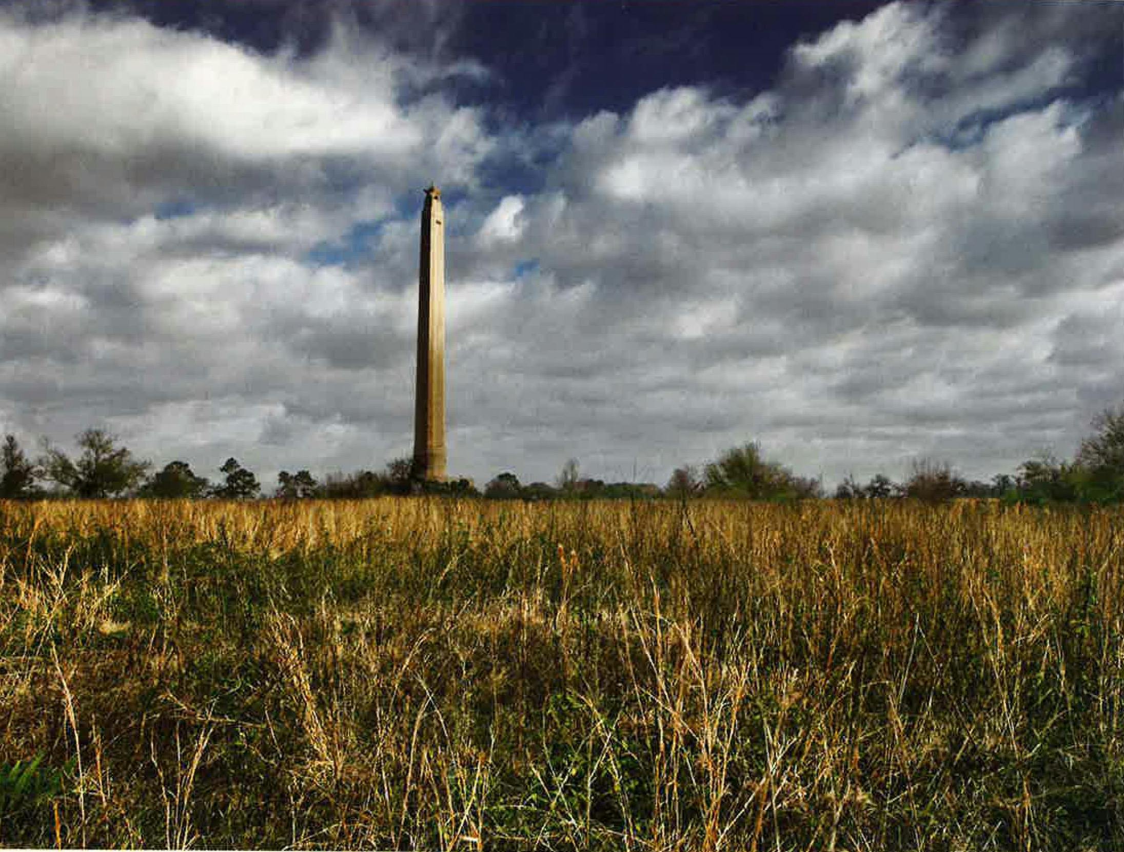
So that I could better appreciate what it was like to be part of the battle, he walked me along the swampy path the Texan army took as it advanced on the Mexican position. Crossing Battleground Road, we headed in the direction of the San Jacinto Monument (as Miss Bayless never tired of reminding us, at nearly 570 feet, it is the tallest masonry column in the world). It rises from the crest of a ridge that gave cover to the advancing rebel army. The grounds crew had mowed a wide strip along the route, but Hardin insisted that we thrash through the tall grass, as Houston had.
I also wanted to appreciate the battle from Santa Anna’s point of view, so we headed toward the far side of the field. There were no walkways or statues at the Mexican camp, no gravestones marking the 630 soldiers who were killed.
The Mexicans never saw the Texans coming. Santa Anna had expected Houston to attack on the evening of April 20, so he kept his troops up all night building barricades and breastworks. He then prepared for an attack at dawn, but that didn’t happen either. At about nine o’clock in the morning on April 21, Mexican reinforcements arrived, hungry and exhausted. As shadows began to fall across the field late in the afternoon, Santa Anna gave an order to stand down. The men collapsed on their blankets, and according to legend—which Hardin disputes—Santa Anna went off to his tent to entertain a mulatto beauty who later became known as the Yellow Rose of Texas.
“It drives me crazy to hear people say that Houston held off his attack until the Mexicans took their siesta,” Hardin told me.
“Yeah, I remember my Texas history teacher telling us, ‘Isn’t that just like a Mexican?’ ” I replied.
The battle began at about four-thirty with a deadly shower from the Twin Sisters, a pair of cannons donated to the rebel cause by the people of Cincinnati. At the same time, Mirabeau Lamar’s horsemen charged on the Mexicans’ left flank, and a four-piece band broke into its version of “Will You Come to the Bower?” Houston, mounted on his great stallion, Saracen, led rebel infantrymen as they swarmed the camp, mowing down the Mexicans before they could reach their weapons. Santa Anna had made the mistake of positioning his troops with their backs to the marsh, so there was no retreat.
The battle lasted just eighteen minutes, though the killing went on for hours. With memories of the Alamo and Goliad still searing, the bloodthirsty rebels committed atrocities every bit as deplorable as the Mexicans had. Mexicans fleeing into the woods were hunted down and slaughtered. Some were scalped. Others ran into a shallow pond called Peggy Lake. Rebel soldiers pursued and stood at the water’s edge, shooting them for sport.
Hardin and I stood on the banks of the water for a time, trying to reconcile the price of liberty with the horror of this kind of warfare. As my friend Stephen Harrigan once observed in this magazine, “The Texas Revolution, for all its airs, was in its darkest aspects a mean little race war.” It didn’t start that way. It started as a rebellion against Santa Anna’s rule. But Harrigan was right: In time it became something else.
The Council House Fight
Location: San Antonio
Date: March 19, 1840
Casualties: 42 killed
The Great Raid of 1840
Location: Victoria and Linnville
Date: August 6—8, 1840
Casualties: At least 23 killed
The Battle of Plum Creek
Location: Near Lockhart
Date: August 12, 1840
Casualties: At least 80 killed
San Jacinto didn’t mark the end of our troubles with Mexico, but an equally formidable enemy, the Comanche, lurked on the horizon. On March 19, 1840, 33 Comanche chiefs and warriors, accompanied by 32 tribe members, met with the Texans at the Council House on the Main Plaza, in San Antonio. The Indians sought to make peace; Texans wanted the release of captured Anglos. The fateful meeting was arranged. What started as a negotiation erupted instead into the Council House Fight, in which the Comanche, who had come under a flag of truce, were slaughtered. Today a marker on the Main Plaza identifies the site.
As a show of faith, the Comanche chiefs had brought along an Anglo captive, a sixteen-year-old girl named Matilda Lockhart. When the Texans saw her, they were outraged: Her face had been badly disfigured, and her nose had been burned. After a tense exchange, the Texas militia entered the courtroom and took positions along the walls. When the chiefs realized they were about to be captured, they began shooting arrows and attacking with knives, at which point the soldiers opened fire. Of the 65 Comanche in the party, 35 were killed and 29 taken prisoner. Only 7 Texans died, but the ugliness did not end there. When other Comanche learned of the betrayal, they tortured to death 13 captives, including Lockhart’s six-year-old sister.
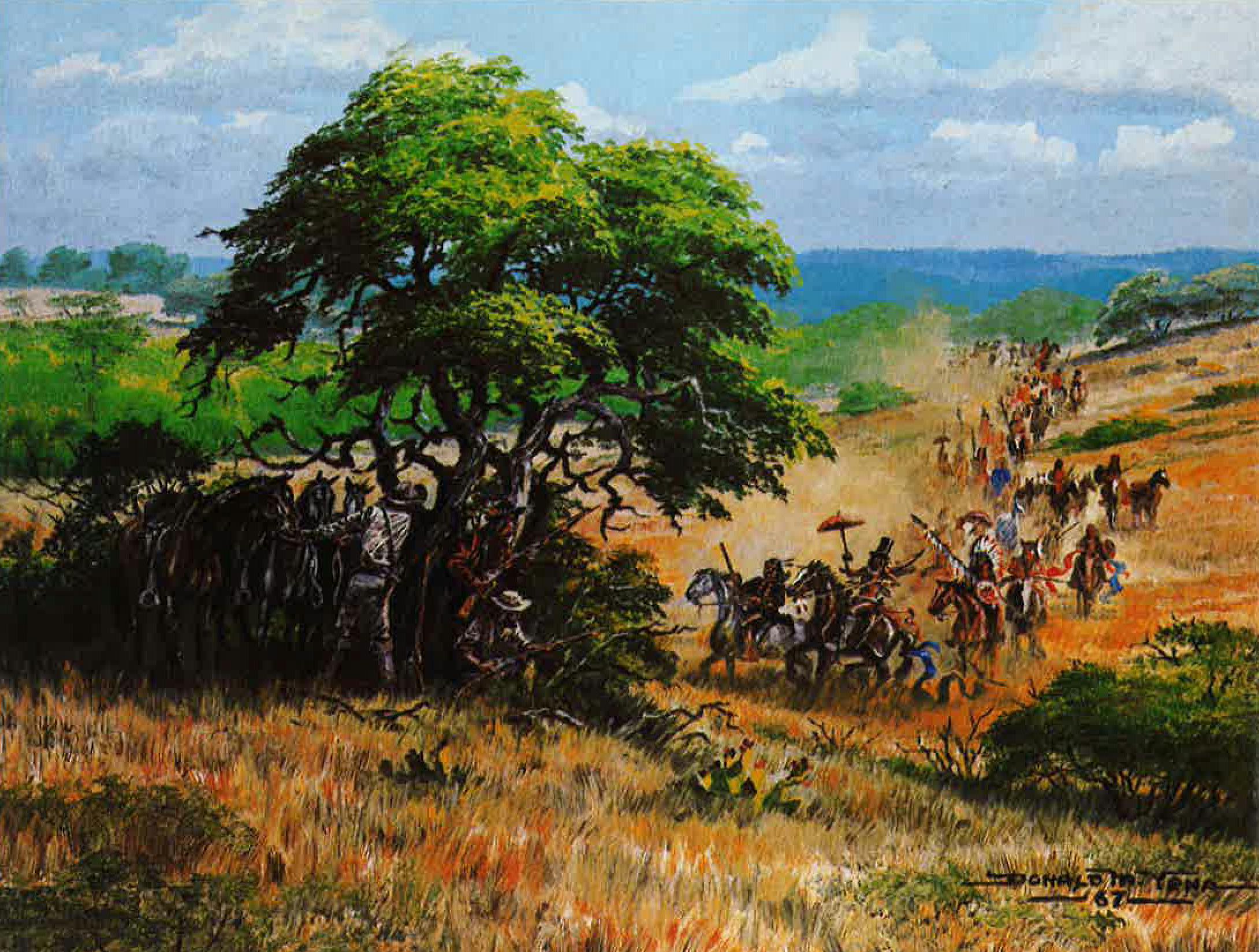
Shocked by the violation of a council, Chief Buffalo Hump gathered a party of as many as one thousand warriors and launched the Great Raid of 1840. Crossing into Central Texas, the warriors swept across the Guada-lupe valley. First they sacked the town of Victoria, killing several residents and stealing more than 1,500 horses, and then they headed for the Gulf Coast. On August 8, 1840, the Comanche galloped into Linnville, a key port in the Republic of Texas, and burned it to the ground. Taking refuge aboard a schooner and other small boats anchored in Lavaca Bay, the people of Linnville watched in astonishment as the Indians rode among the buildings, dressed in top hats and New Orleans millinery and shading themselves with umbrellas that had been plundered from a local store.
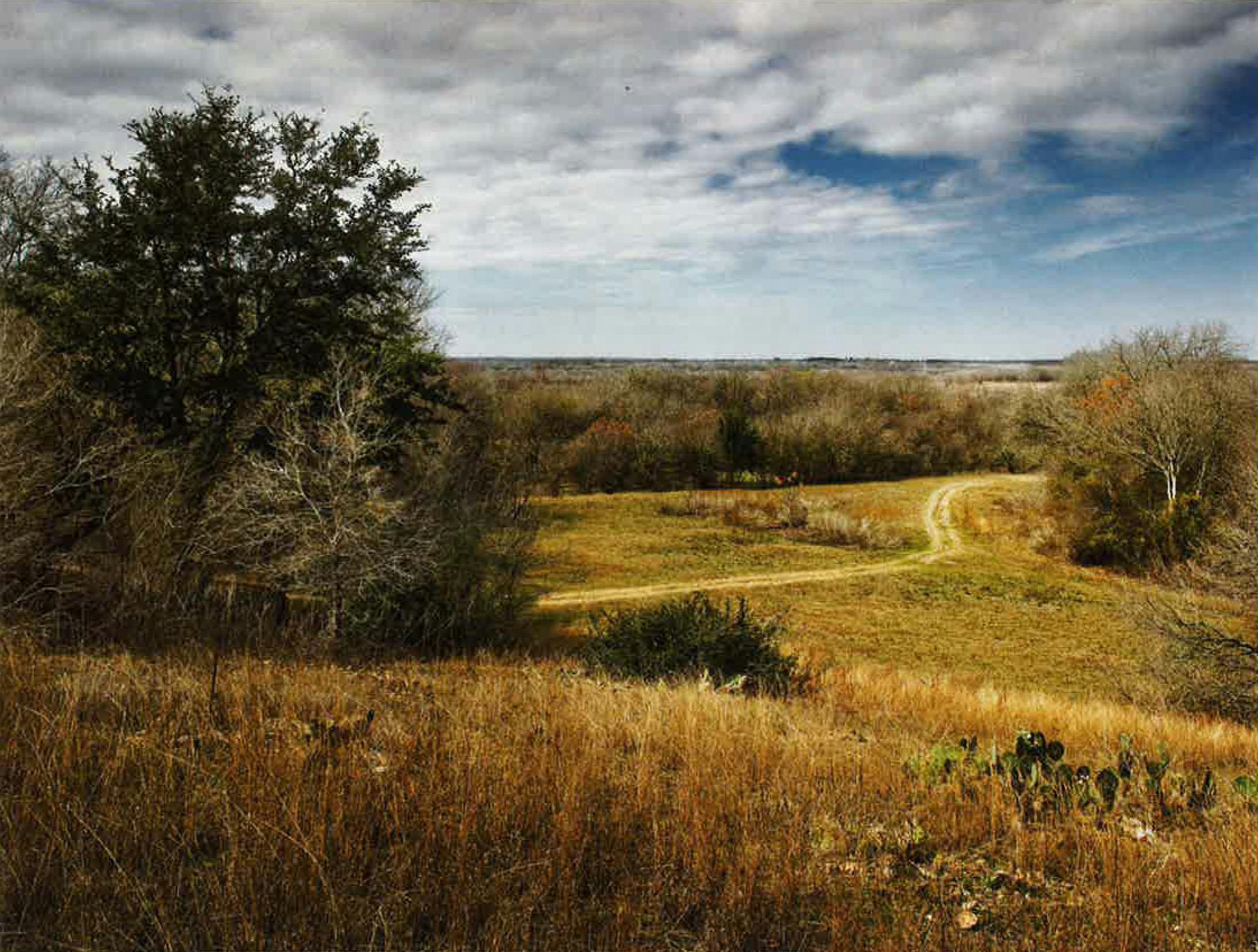
Linnville has vanished from the map, but I determined its location with the assistance of Nelson Marek, a steward for the Texas Historical Commission in Calhoun County. Marek first drove me to a historical marker on FM 1090, just across the road from a Lavaca city limits sign. The marker used to sit on the bay front, about a mile northeast of its present location, but it was moved to a more secure site a few years ago. To reach the place where Linnville once stood, we drove down Maxwell Ditch Road to Bay Meadow Drive to a private gravel driveway that led to a thirty-foot bluff overlooking the bay.
“Linnville was on a bluff like this,” Marek said. “Now it’s a couple of hundred yards out in the bay. Hurricanes have rearranged this coastline.”
After looting Linnville, the Comanche headed north. But the Texas Rangers, led by Benjamin McCulloch, and a volunteer force gave chase. They intercepted the Indians at Plum Creek, near Lockhart. A marker a few miles north of Lockhart State Park commemorates the Battle of Plum Creek. The Indians tried to defend themselves, but they were easy targets because they were weighed down by their stash of bullion. The Texans reported killing eighty Indians. After recovering the stolen loot, the Texans abandoned the fight, divided the booty, and headed home.
The Second Battle of Sabine Pass
Location: Sabine River at the Gulf of Mexico
Date: September 8, 1863
Casualties: Approximately 230
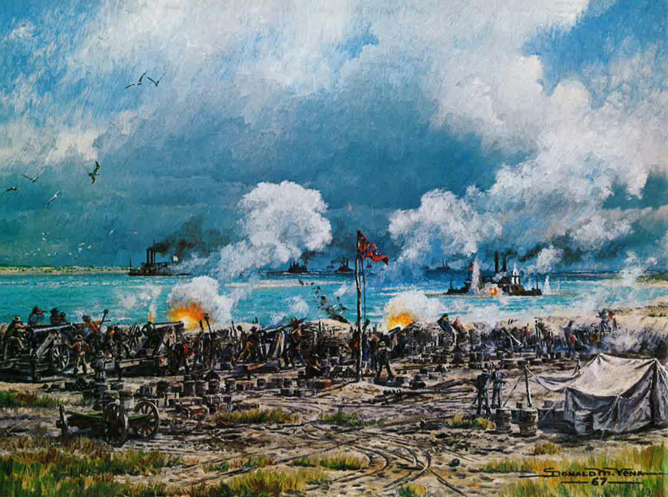
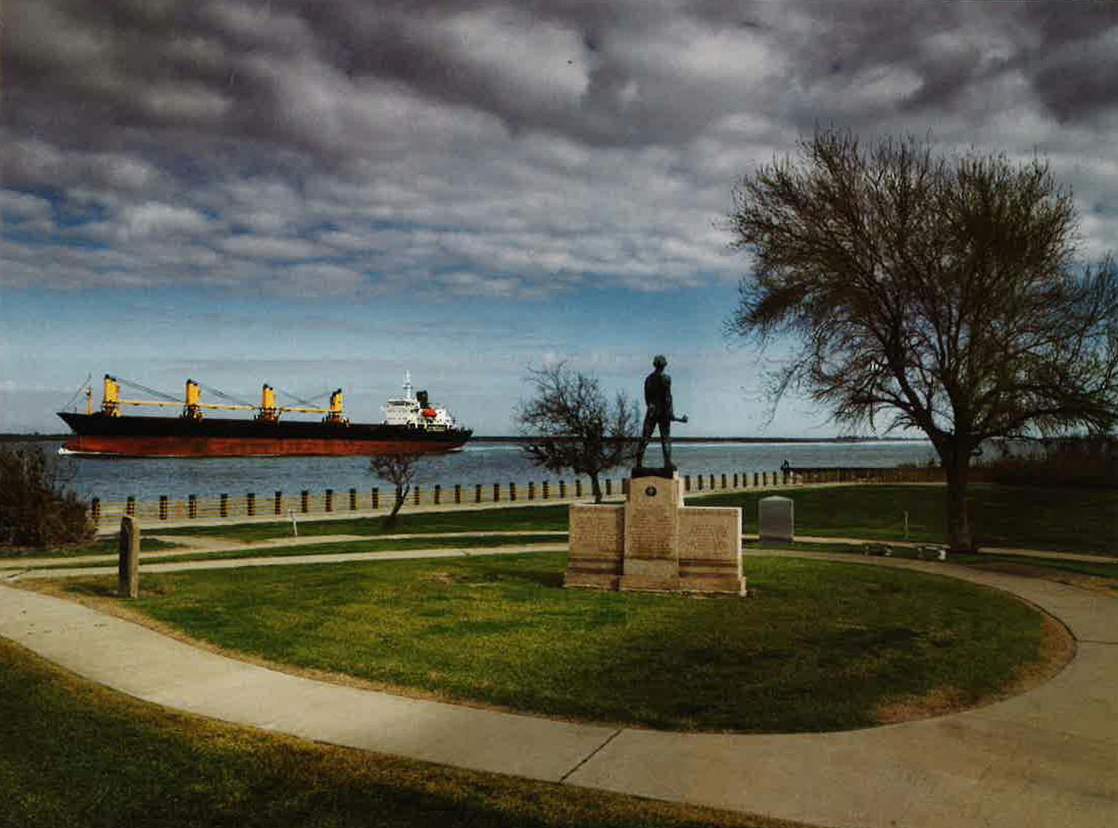
Though Texas was spared most of the horror of the Civil War, it featured a few improbable battles. Although Hurricane Ike has damaged the Sabine Pass Battleground State Historic Site, I was relieved in early January to find that at least the road was open and that the seven-foot bronze statue of a bare-chested Richard “Dick” Dowling, the hero of the Second Battle of Sabine Pass, still guards the site of old Fort Griffin. On September 8, 1863, this Confederate artillery officer and his skimpy crew of about forty Irish longshoremen prevented four thousand Union soldiers and four gunboats from entering Sabine Pass. An overly exuberant Jefferson Davis called the Confederate victory “without parallel in ancient or modern war.”
“It didn’t change the outcome of the war, but it did prevent the Union from coming back to Texas,” Archie P. McDonald, a professor at Stephen F. Austin State University, in Nacogdoches, told me. “It gave the Confederacy a shot in the arm at the time.”
The Union had been trying for weeks to gain a foothold in Texas. The plan was to capture Sabine Pass, seize the railroad, and take Houston and Galveston. General William B. Franklin commanded the armada. He knew that the Confederates had recently constructed Fort Griffin, an earthwork that mounted six cannons and commanded a strategic position over the pass, which connects Sabine Lake with the Gulf of Mexico. What he didn’t know was that Dowling had been doing some target practice, firing at markers that his engineers had driven into the oyster reef 1,200 yards from the fort, zeroing in at the guns’ most accurate maximum range.
The pass is so narrow that I could see from one side to the other, but on the day of the attack Dowling kept his men out of sight. When he spotted the two lead gunboats with his spyglass, he ordered his men topside. Dowling held his fire, content to allow the crews aboard the attacking boats to speculate that the Confederates had deserted. Only when the boats passed the 1,200-yard mark did Dowling order his men to commence firing. One of the first shots hit the boiler of the Sachem, rendering it immobile. Another shot shattered the boiler of the Clifton, which then ran aground. Two other Union gunboats eventually turned tail.
Dowling and his small band of men took three hundred prisoners, and the bulk of the armada raced toward New Orleans, dumping horses, mules, artillery, and gunpowder overboard to lighten its load.
The Battle of Palmito Ranch
Location: Near Brownsville
Date: May 12—13, 1865
Casualties: Unknown
The last land battle of the civil war was fought on a spit of land at the southernmost tip of Texas, near where the Rio Grande meets the Gulf of Mexico. The date was May 1865, more than a month after Robert E. Lee surrendered at Appomattox. Myth has it that the two armies didn’t know the war was over, but that’s not true. Neither side was ready to stop fighting.
The site of the Battle of Palmito Ranch is twelve miles east of Brownsville, on Texas Highway 4. A historical marker describes a fight in which the old Texas Ranger and Indian fighter John “Rip” Ford routed an exhausted Union force. One of the oldest ranches in the area, Palmito was originally part of the Espiritu Santo Spanish land grant. The federal government owns most of the site, but a few tracts are privately owned, like the one that has been in Antonio Zavaleta’s family for 150 years. “This land looks almost exactly as it did in 1865,” said Zavaleta, an anthropology professor at the University of Texas at Brownsville. “If the combatants came back today, they’d have no trouble recognizing it.”
The Confederates had learned of Lee’s surrender two weeks earlier, from a copy of the New Orleans Times. Several hundred rebels had already headed home, but those who stayed remained devoted to the cause. Union troops, meanwhile, had received an erroneous report that the Confederates were preparing to evacuate Brownsville. Acting on this bad intelligence, the Union commander, Colonel Theodore H. Barrett, had ordered a detachment to march toward the city. That’s when they ran into a Confederate buzz saw.
Ambitious but inept, Barrett had advanced without cavalry or sufficient artillery; Ford had both. His men hid in a grove of small trees as they formed their battle lines, then took the Union troops by surprise. Barrett ordered his men to fall back, or, as Ford described it in his memoirs, “seemed to have lost his presence of mind.” Demoralized Union soldiers bolted, and Ford’s men chased them for seven miles, at which point Ford decided to “let well enough alone and retire.”
Historians disagree on the number of deaths, but Fehrenbach called it a staggering victory for the Confederates, while “Union dead lay all over the battlefield and strung over the seven miles to the sea.”
The Second Battle of Adobe Walls
Location: Adobe Walls
Date: June 27—29, 1874
Casualties: Approximately 74 killed and wounded
Miss Bayless didn’t talk much about the Indian wars. But I’d heard about Adobe Walls, the old trading post for buffalo hunters, from my granny. She was part Comanche and a great admirer of the tribe’s last war chief, Quanah Parker. Unfortunately, the Second Battle of Adobe Walls signaled the beginning of the end for his people.
Before searching out the site, which is just north of the Canadian River, in the Panhandle, I stopped in Borger to talk to Ed Benz, the director of the Hutchinson County Historical Museum. “There were at least eighteen battles and skirmishes in the area, including an earlier Battle of Adobe Walls, in 1864,” Benz told me.
Like so many battlegrounds in Texas, the site is located on private property, in this case on the Turkey Track Ranch, which is owned by the Whittenburgs, a prominent Panhandle family. But just one mile to the north, the family has donated a two-acre site, where the Second Battle of Adobe Walls took place. This was the spot I was looking for.
Benz had warned me that there is nothing left of the outpost, but the museum contains models of how it looked in 1874: The Myers and Leonard store, where 50,000 buffalo hides were stacked; the mess halls and stables; and Hanrahan’s Saloon, where most of the 28 buffalo hunters held out during the battle.
Benz treated me to a routine he had worked up for the museum’s annual tour of Adobe Walls, which will be held on June 13. He had internalized the voices of some of the most famous buffalo hunters—the crack shot Billy Dixon, an agile buffalo skinner called Frenchy, and an eighteen-year-old gunfighter named Bat Masterson.
For the Comanche, life on the South Plains revolved around the buffalo, 50 million of which roamed the area. But that began to change in 1874, when a caravan of hunters, skinners, and traders from Dodge City established Adobe Walls.
“Dodge City was an end-of-the-track town,” Benz said, slipping into the character of Billy Dixon. “Colonel Dodge, who founded Dodge City, told us, ‘Boys, go where the buffalo are, down in the Texas Panhandle.’ Well, he was right. There were buffalo as far as you could see—an ocean of them. We came for the money and the adventure. We wanted to see Indians, wanted to have a fight. We knew that if we built a fort, they would show up. And they did, on June 27, 1874.”
Finding the site of Adobe Walls was trickier than I had thought. I drove north out of Borger on Texas Highway 207. Twelve miles past the town of Stinnett, I nearly missed a small green “Adobe Walls” sign on the east side of the highway. Turning right, I drove as far as I could, then headed south where the blacktop became a gravel road. I finally found a sign identifying Turkey Track Ranch, but the public road ended at a locked gate. I was puzzled for a minute or two, until I realized I had found it—Adobe Walls. Not exactly what I’d imagined.
The Panhandle Plains Historical Museum, in Canyon, maintains the site and has had the sense to leave the grass on either side of the road in its natural state, but it was so tall that at first I didn’t see the two markers or the three grave sites. The main monument, erected in the twenties, celebrates the heroism of “28 brave frontiersmen” who repulsed seven hundred warriors. Nearby, on what would have been the location of Rath and Company Store, is Dixon’s grave marker. Only in 1941 did it occur to folks to erect a second monument, for the Indians who “died for that which makes life worth living.” Across the road are the graves of the Shadler brothers, buffalo hunters who were sleeping under their wagon when the Indians attacked. The Comanche killed them on the spot, then scalped their dog.
With a sharp wind stinging my eyes, I walked to where I thought Hanrahan’s Saloon once stood, trying to imagine that morning. Quanah Parker, the son of Chief Peta Nocona and Cynthia Ann Parker, was the Comanche war chief, but he was influenced by his spiritual adviser and medicine man, Isa-tai, a name that translates as “coyote droppings.” Isa-tai had convinced his tribe that his magical powers would cause the bullets of the white men to pass harmlessly through the warriors’ bodies. The tribe was desperate: They could see that their time as lords of the plains was nearing an end.
Isa-tai’s strategy was to attack while the hunters slept, and it might have worked except for an unforeseen incident: A lodge pole that supported the roof of the saloon cracked with what sounded like a rifle shot. The hunters were in the process of repairing the roof when the Indians made their move. In his biography Dixon spoke admiringly of “the splendidly barbaric sight . . . [of] hundreds of warriors, the flower of the fighting men of the southwestern Plains tribes, mounted upon their finest horses . . . coming like the wind.”
Taking cover behind the sod walls, Dixon and the other marksmen used their heavy long-barreled rifles to mow down the flower of Indian manhood. In the early fighting, more than a dozen warriors were shot dead, putting to shame Isa-tai’s proclamation. By the third day, the Indians were thoroughly demoralized. That’s when Dixon showed his own brand of magic. Parker and some of his chiefs had ridden to the top of a mesa to assess the situation. Though the Indians were nearly a mile from the saloon—the exact distance was 1,538 yards—Dixon rested his Sharps .50-caliber rifle across some feed sacks, took aim, squeezed off a shot, and watched in amazement as a warrior fell from his horse. Parker knew it was over for his tribe. Less than a year later, he would be the last Comanche chief to surrender.
Walking back to my car, I looked again at the mesa where Dixon had fired his amazing shot. I stood there for maybe half an hour, breathing history in the raw, tasting the fresh winter air, feeling small but alive. That’s what this journey had awakened in me, a sense of renewal, of a living past that has always been there, just a step away, amused at our innocence. I had never really appreciated the scope and diversity of who we are and where we came from, our uniqueness, what Hardin had called the exceptionalism that is the core of the Texas character. I had dwelled on the violence, the bloodshed, and the treachery, and there is much there to dwell on, but I had overlooked the magnificent blend of the people, their strength of purpose, the staggering odds that they all found their way here and played their roles with such fidelity and patience. It was almost as though their lives had been scripted. But that was crazy. Who would write such a script? And who would buy it? Those were the eternal questions for history, and history had no time for them.


