

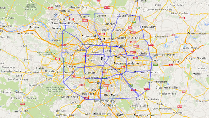

Houstonians live in a really big city. We know that people know that, but thanks to an intrepid Reddit user, we now have a succinct visual shorthand for just how big the city really is: Namely, these maps, which overlay the 88 miles of Beltway 8 on top of a number of other major world cities.
The maps, created by a Reddit user with the handle “Youllfindaway,” help explain why going from one end of Houston to another seems like a gargantuan task, while a commute across, say, San Francisco doesn’t even come close to comparing. Take a look:
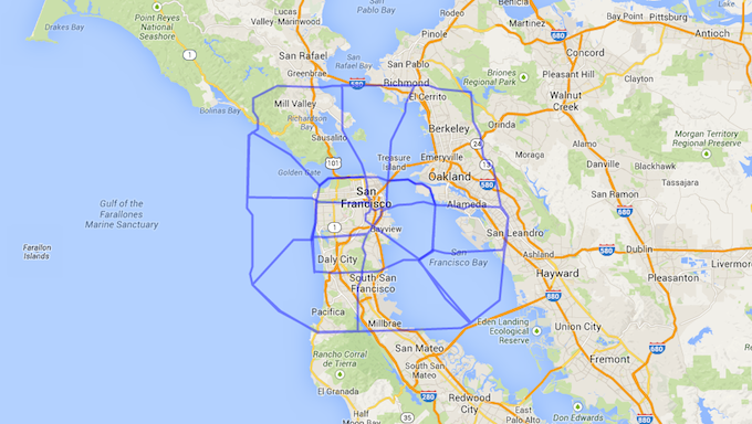

A trip from Northwest Houston to Southwest Houston, in other words, is the equivalent of a trip from the Pacific Ocean into the middle of the San Francisco Bay. That’s a heck of a distance to cover. And it doesn’t get easier in New York:
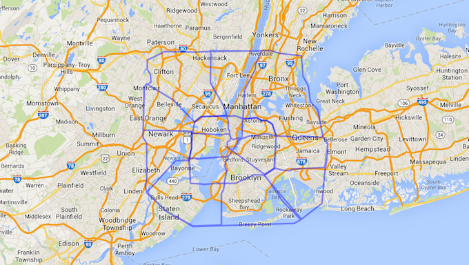
A quick jaunt to visit your friend who lives across town in Houston is the equivalent, for our East Coast friends, of dropping in on their pals who live in Paterson, New Jersey from Rockaway Park. That’s not a trip that many people choose to make as part of a daily commute.
All of this helps explain why Houstonians think very little of spending hours in the car getting from point A to point B. Their city basically demands that they cross distances that, in other places, make the inconvenience of getting around more explicit by placing state lines or major bodies of water between them. That’s perhaps not better illustrated anywhere than in the image of the Beltway superimposed over Honolulu:
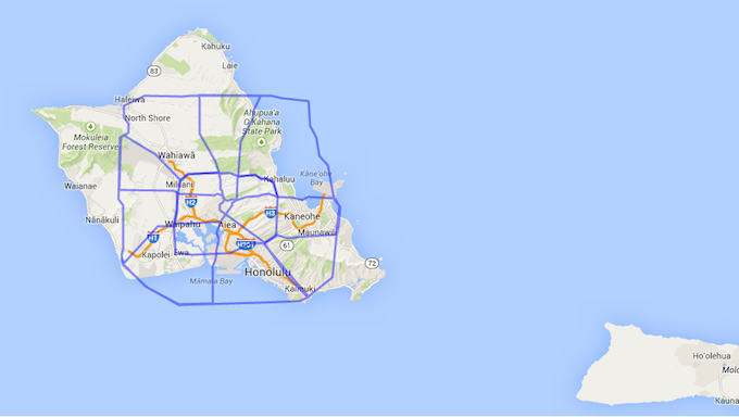

Yup, Houston by itself is roughly the same size as the entire island of Oahu.
But Honolulu, Manhattan, and San Francisco are famously small cities, which is why they’re the most expensive in the country—there just isn’t a lot of space there, even if there are a lot of people. Do these maps rig the deck by picking populous, but geographically small, U.S. cities as their basis for comparison? How does Houston compare to a geographic behemoth like, say, London?


A journey that covers roughly the same distance as a trip from the airport to the intersection of the Beltway and I-69 in Houston would get a London commuter from the suburb of Watford to the suburb of Epsom. That trip would take two hours, and require a 34-minute ride on an overland train to get to an underground train, which the traveler would then take to get to another overland train, where they’d spend 20 minutes before enjoying a brisk 7-minute walk to a bus station, which would finally drop them off at their destination.
And all of this merely demonstrates the size of the city of Houston proper. If you want to get from The Woodlands to, say, League City? You’re basically in Scotland now, buddy.
This is all especially relevant right now, as a city like Houston increasingly grows to the point where it’s competing on its own terms with cities like London and New York, in terms of size and urbanization. As Mimi Swartz highlights in her Texas Monthly piece on local government in the city, Houston is in a bit of a flux situation right now—and maps like these demonstrate just what the city has at stake.
(All images by Reddit user youllfindaway)


