


When, in the spring of 2008, agents of the Bureau of Land Management showed up at Pat Canan’s property, northeast of Wichita Falls, he didn’t think much of it. “We actually let them in through the gate,” he says, dryly. The BLM, which oversees federally owned land, told him that it was taking a closer look at a 116-mile stretch of the Red River, which serves as a border between Texas and Oklahoma. The BLM agents said they were reviewing their holdings and mapping the southern boundaries of the tracts along the north side of the river that had been dispensed to the Kiowa, Comanche, and Apache tribes a century ago.
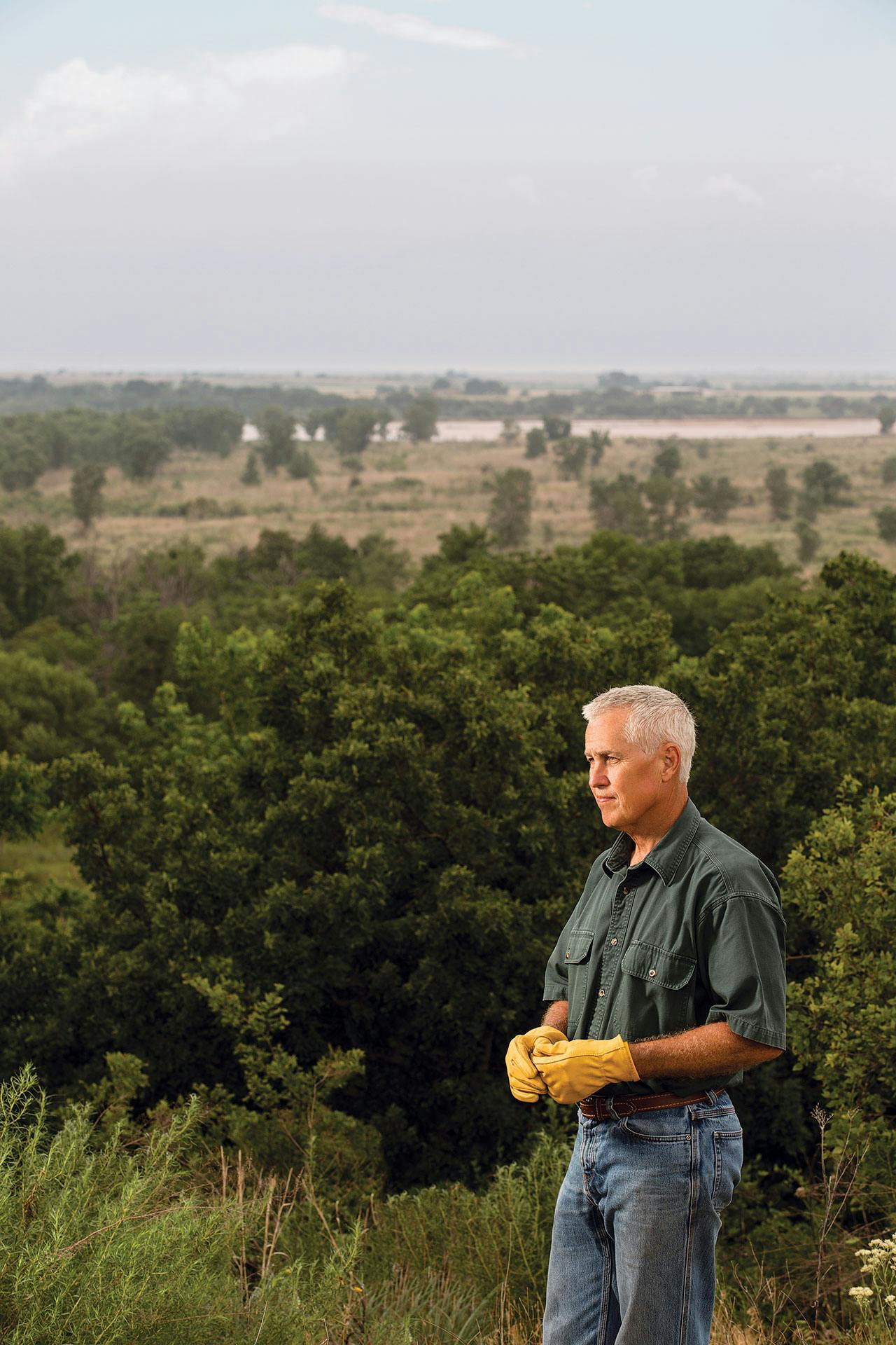
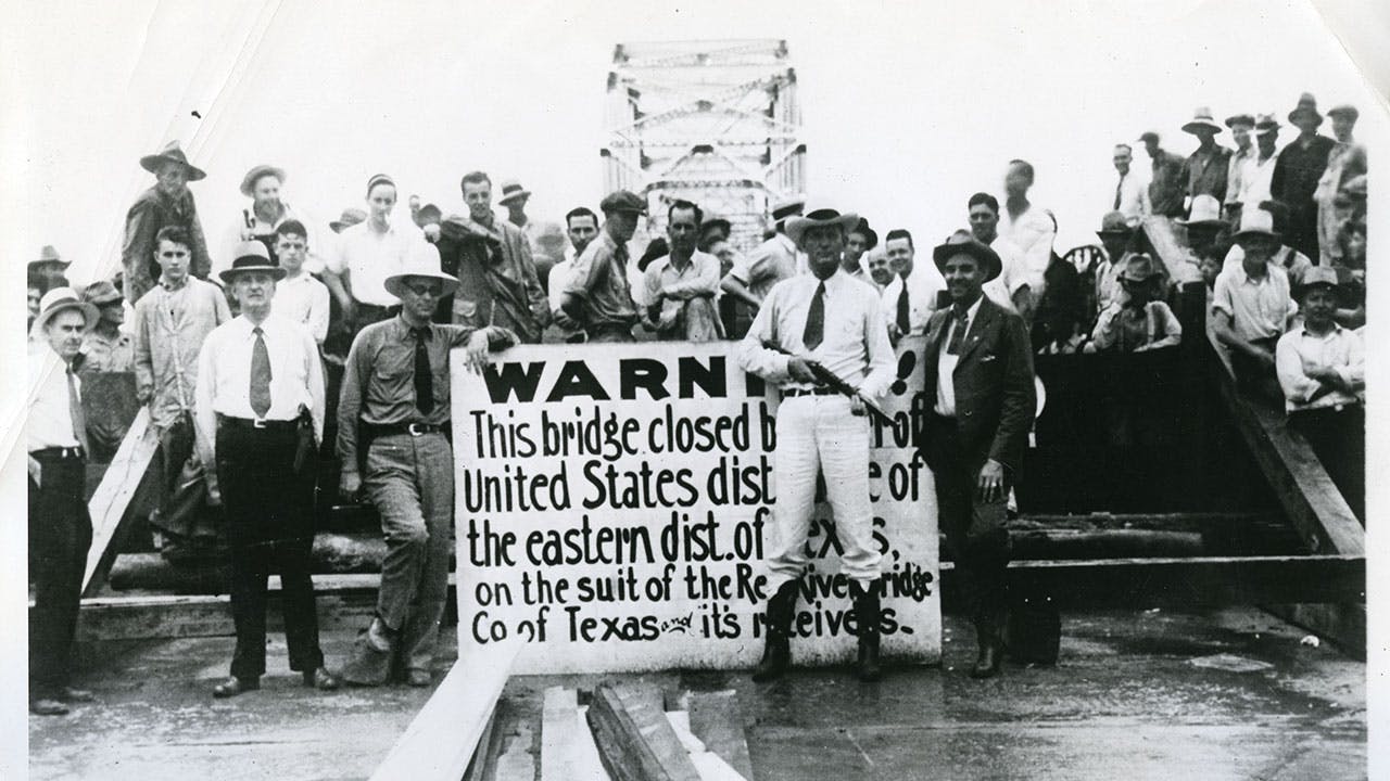
The area by the Red River has long been a site of conflict—the Battle of Pease River and the Red River Bridge War took place not that far from Canan’s land—but these days it’s home to ranchers and country homes. Canan hunts and fishes and owns a few head of Longhorn cattle—“pasture art,” he says. It’s not a bad life. The two thousand acres he lives on have been in his family since 1962—the original deeds date back to 1858—so he didn’t think he had reason to worry when the BLM showed up at his doorstep.
As it turns out, he was wrong. In 2013—nearly six years after the visit—Canan was told that rather than owning 2,000 acres of land, he actually owned about 600; the other 1,400 belonged to the federal government. Canan was baffled. His house overlooks a bluff that runs roughly parallel to the riverbank, about a mile inland. The BLM judged that
bluff to be the river’s south bank—everything between it and the river was now government land. As we walk his property one afternoon, Canan points to where the BLM had placed a metal marker denoting the middle of the river. It’s about two thousand feet inland. He motions to the thick clumps of tall grass, wildflowers, and tree breaks. “Aquatic plants, I suppose,” he says.
Landowners here know that they may slowly lose or gain land over time because of the gradual shifting of the river. But this was something entirely different. Over the few months that followed that initial visit, the BLM repeated the procedure throughout the area, eventually asserting that it owned some 90,000 acres of formerly Texan soil. It claimed 600 acres of Kenneth Aderholt’s 1,250-acre ranch, including his home, in Wilbarger County; 750 of Ronald Jackson’s 1,138 acres in Clay County; and 100 of Jimmy Smith’s 150 acres in Wichita County.
After trying to get the agency to reconsider (eventually, the feds would reduce the size of their claims, to 30,000 acres), last November Canan and a few other landowners—along with the governments of Wichita County, Wilbarger County, and Clay County and Clay County’s top lawman, Sheriff K. R. “Kenny” Lemons Jr.—filed a lawsuit against the BLM, with the help of the Texas Public Policy Foundation, the Austin-based conservative think tank. A tentative trial date has been set for next March, but such cases can wind their way through the courts for years. Sunk in a chair in his ranch house, kitted out with hunting trophies and Texas ephemera, Canan strikes a philosophical note. “This has been educational,” he says.
You might think that a river would make an ideal border, that it would obviate the need for legalistic squabbling. But people have been arguing over the Red River for longer than Texas has been around. It was a source of conflict as soon as it appeared on a map, and it’s never stopped being one.
The Adams–Onís Treaty of 1819, which resolved boundary disputes between the empire of Spain and the United States, set the border between the two as the “river Sabine” on the east side and the Red River and the Arkansas River on the north. But two problems emerged immediately. First, while the treaty specified the west bank of the Sabine and the south bank of the Arkansas as borders, it didn’t make clear which bank of the Red was regarded as the border. Second, the map that the signatories were referring to, produced by a Philadelphia mapmaker named Melish, portrayed the Red River, which forks, as one channel, later causing a great deal of confusion over the precise location of the border.
After Texas became a republic and then a state, it inherited the border disputes. Texas claimed that the North Fork of the Red River should serve as the border and that it was entitled to all land south of it. The U.S. government claimed all the land north of the South Fork. It wasn’t until 1896 that the U.S. Supreme Court awarded the disputed acres to the federal government, which affixed them to the Oklahoma Territory.
But the question of which riverbank to use as the border persisted. In the 1923 case Oklahoma v. Texas, the Supreme Court declared that the south riverbank was implied by the text of the 1819 treaty and defined the riverbank as the place where the muddy channel of the Red begins when the river is flowing at “substantial volume,” a line that the court additionally specified was “relatively permanent.”
Following the ruling, a new survey was conducted and the boundary, finally, was set. Until, that is, the late seventies and early eighties, when several Oklahoma landowners sued in federal court, claiming land on the other side of the river. A judge in the Western District of Oklahoma essentially agreed with them. To represent the riverbank on a map, he drew a line that sometimes coincided with the high bluff rather than the low, muddy bank the Supreme Court had chosen.
Once again, the land was in dispute. In 1999 representatives of both states worked out what was known as the Red River Boundary Compact, which set the line of political jurisdictions at the line of permanent vegetation, which roughly corresponds with the line formed by the rim of that muddy bank. But the compact didn’t settle the issue of private property lines. So for years, many Texas landowners have been attempting to secure their old land. Last year, one farmer, Tommy Henderson, bought back land he’d lost in 1984.
But the BLM’s claims in 2008 extended its reach to many other properties. Though the agency declined to talk specifically about Canan’s case, the BLM argues that at points along the river, areas similar to the low-lying portion of Canan’s property are “false banks”—that the river, when at full strength many decades ago, would have extended significantly further to the south. And so the line should be drawn there, even if no water has flowed there for many years.
The agency’s hands are effectively tied, says Steve Tryon, the field manager for the BLM’s Oklahoma office. “This all started with the very innocent idea that we ought to go and figure out what the public wants to do with public land,” he says. Once every twenty years or so, the agency reviews all land for which it is responsible. Tryon and the agency had the impression that the federal government had long owned a sliver of land south of the middle of the river. But, perhaps fearing a messy fight, the BLM had kicked the can down the road for decades, until Tryon picked it up.
The agency’s obligations, it turns out, are somewhat labyrinthian. According to Tryon, the BLM is less interested in the surface of the land than in what’s beneath it. Owing to an unusual set of circumstances and congressional action that dates to the thirties, royalties from oil and gas extraction on federal land along the Red River must be passed to the Kiowa, Comanche, and Apache tribes. Though the area had a lot of oil action early in the twentieth century, none of the litigants’ land has oil wells today. All that’s left in the surrounding area is low-yielding secondary recovery wells. But as a rule, Tryon says, the feds never voluntarily forfeit mineral rights. “That’s something that the U.S. routinely falls on its sword for,” he says.
Robert Henneke, the Texas Public Policy Foundation’s general counsel and litigation director, says that in the course of the legal proceedings, the BLM has never clearly articulated the “tribal interests” it purports to represent and that the justification for the claim has little to do with the claim’s correctness; the lines the BLM drew, he says, are simply wrong. Nor would his clients be willing to surrender the mineral rights to their land to retain the surface rights. “They have the law on their side,” he says. “They want to keep full title to the property they clearly own.”
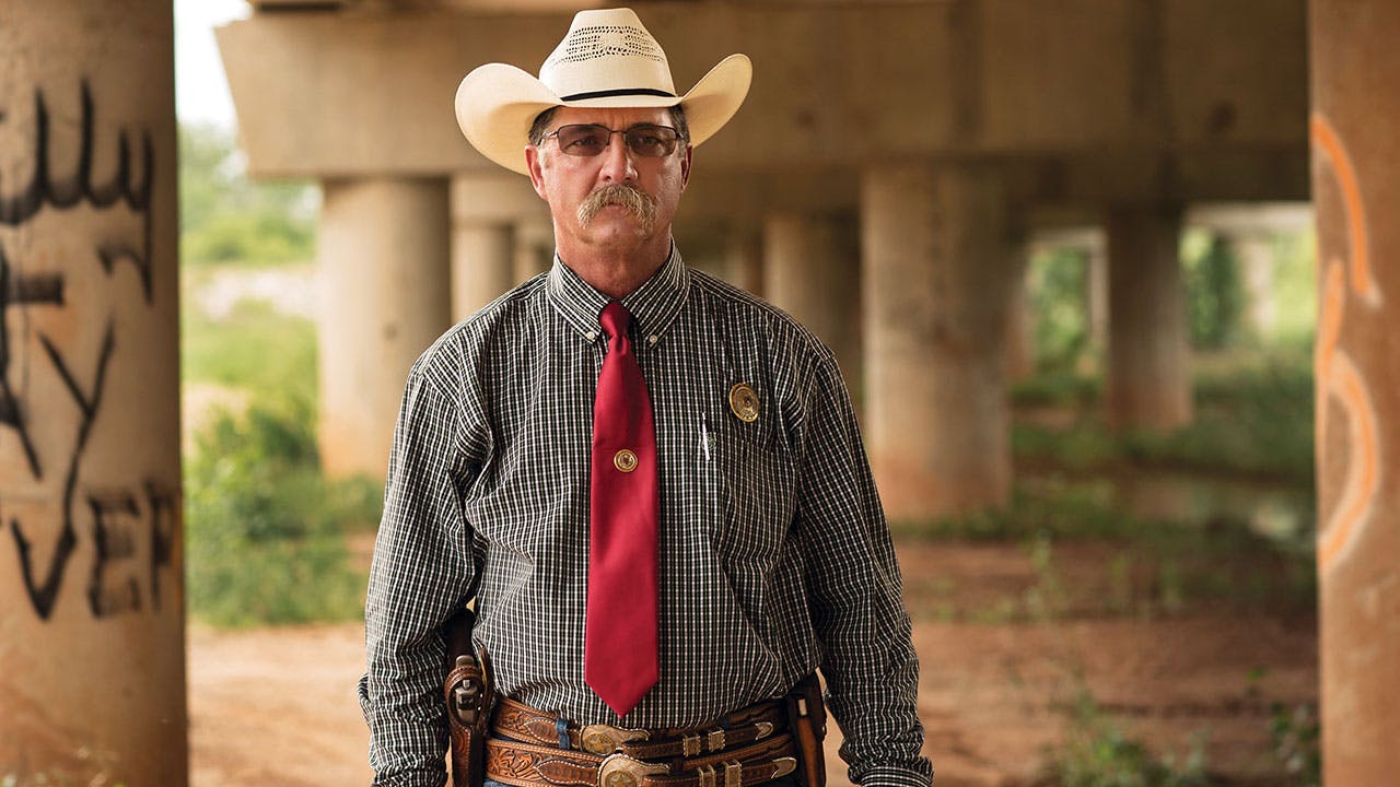
Sitting on Canan’s hearthstone, mustachioed and hatted, Sheriff Kenny Lemons Jr. explains why he got involved in the lawsuit against the BLM. “What we have is a problem with enforcement of the law,” he says. “It involves criminal trespass, criminal mischief, tearing fences, things like that.” Before the BLM took its stand, landowners’ fences helped keep order. Now much of the area is unfenced, and things have gone a bit haywire. The only way for the public to access the river in Clay County is via an area beneath the bridge along Texas Highway 79 between Byers, Texas, and Waurika, Oklahoma. That’s been a party spot for a long time, Lemons says, and it’s gotten only more raucous in recent years. “It’s like Mad Max: Beyond Thunderdome,” Canan says.
“You can go there just about any nice weekend in the spring and summer and there’ll be hundreds of people down there at that bridge, camping out, four-wheelers going up and down, tearing up the vegetation,” Lemons says. “There’s drinking, partying, fighting. But it’s not a portion of the county that we actively patrol.”
Patrolling the river and the adjoining land requires specialized vehicles, like airboats and ATVs. “We’re not set up for that,” Lemons says. “Nor do we have the manpower.” It’s unclear who’s responsible for monitoring the area; Lemons says the county can’t do it, and the feds don’t seem interested in committing the resources.
Tryon says the BLM is trying to figure out a better way to handle the area. “We’ve never actually actively managed it,” he says, acknowledging that the Oklahoma office doesn’t have the resources or the expertise. “We’ve passively managed it.”
The fair weather season is just starting when I poke around the bridge in early March, and it’s raining, but there’s a truck with Oklahoma plates loading up two four-wheelers. The muddy stretch under the bridge is marred by off-road tracks, and the pillars are covered in graffiti. The ground is littered with beer cans and shotgun-shell boxes. There’s a busted-up sofa bed with its innards starting to spill out.
Standing outside his house one evening, Canan notes the contrast with his land, which is serene at sunset. There’s a coyote howling in the distance. Bald eagles hunt here. Thick vegetation and wildflowers abound. What interest, he wonders, does the BLM have in putting such a place at risk by opening it up to unmonitored public use?
Adding to the sense of lawlessness is the fear that anti-government groups will seize on the dispute as they did with the Bundy Ranch standoff, in Nevada. “There have been some armed groups, and people who say they’re unarmed, but are associated with militias, who have wanted to get involved with this,” Lemons says. “We don’t need it.”
On Memorial Day weekend in 2014, a group of open carry activists and militia types, some bearing assault rifles, showed up for a rally, the Gathering of the American Patriot, on land owned by one of the litigants. Speakers stood up to slam BLM agents as federal shock troops. Months later, Canan was paid a visit by members of the FBI’s anti-militia division, who were hoping to get a feel for the area in case a “situation” develops.
The symbolism of Texas landowners fighting the feds on one of the state’s frontiers is too juicy for many people to ignore. Governor Greg Abbott weighed in repeatedly on the case during the 2014 election. The TPPF, which took on the case pro bono, is advancing it as part of its long-term effort to mount Tenth Amendment challenges to unconstitutional federal actions.
Tryon, who says he has “a tremendous amount of sympathy for the landowners,” holds out hope that the agency can work out some sort of compromise. But right now it doesn’t seem as if there will be much resolved before the case winds its way through the system.
Canan is grateful for all the outside help, though he’s leery of being drawn into a larger philosophical fight about government power. He just wants to get his land back, so all those Oklahoman poachers will stop cutting his fences and the militia wannabes will stay away. That might be years from now. But whenever the case is resolved, many around here hope it will settle the border dispute once and for all. Or, at least, until the river changes course once again.


