When exploring Texas rivers in my canoe, I like to imagine myself as Slue-Foot Sue, the fictional cowgirl who caught the eye of Pecos Bill while riding a whale-size catfish down the Rio Grande. Sue, a piece of Texas folklore, was created by author Edward O’Reilly and cartoonist Jack Warren in the forties. I got to know her as a master of the state’s untamed waters through illustrations in children’s books in my Austin elementary school library. Through their pages, I was transported to the state’s unpredictable wilds. It’s not all myth: Texans are still beholden to the rivers that shaped the state. You can see them reflected in the design of most Central Texas counties, where the curves of the river are etched into the boundary lines.
Texas’s wild waters are a sharp contrast to its tamed countryside. We rank a dismal forty-seventh out of fifty in terms of the share of total acreage that’s public. Less than 2 percent of the vast expanse of mountains, deserts, plains, swamps, and scrubby backcountry that cover the state is publicly owned. But where our backpacking routes and public trails may be lacking, we’ve got nearly 200,000 miles of navigable waterways. There are another 600 miles of Gulf coastline, the entirety of which a group of Texan paddlers navigated last summer. As for any wary landowners you might encounter along the way? Holly Orr, a canoe instructor who owns San Marcos outfitter Paddle With Style, suggests taking with you a healthy dose of respect for nature and Texas friendliness—most landowners just want to protect the pristine environment, she says. Sharing a six-pack (if there are no local can bans) also wouldn’t hurt.
These spots, which we’ve listed in order from least to most challenging, offer some of the best paddling anywhere in the state. You may or may not see any giant catfish, but, at least for an afternoon, you can travel back in time.
Know Before You Go
Texas law requires that anyone thirteen years old or younger wear a lifejacket at all times while in a recreational vessel 26 feet long or shorter. Adults must have one readily accessible. Always put together a paddle plan, which includes knowing your put-in location, route, and take-out spots, in addition to a plan for getting back to your vehicle. And make sure to check the weather forecast before you head out—flash floods are a serious threat that kill approximately seventeen Texans per year. You can also check the U.S. Geological Survey’s streamflow data to get a sense of how fast the water is flowing.
Caddo Lake/Big Cypress Bayou
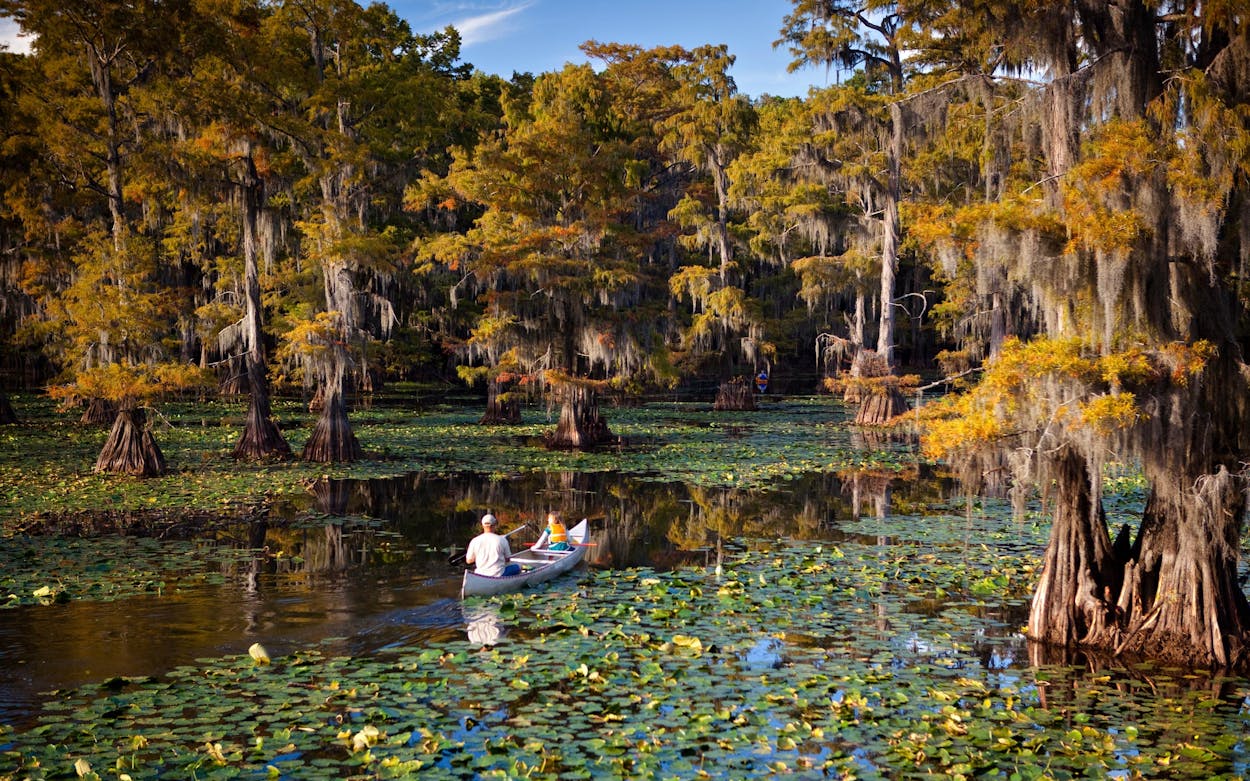
This underrated East Texas destination is an otherworldly escape. The portion of Big Cypress Bayou that flows eastward between Jefferson and Caddo Lake is filled with narrow channels between a dreamy canopy created by trees in one of the world’s largest cypress forests. Toward the end of October, the leaves on those cypresses turn deep orange. Robin Boyd, who co-owns canoe rental shop Ole Mossy’s Up River with her husband, points out a fringe benefit of lower water levels this fall. “All the cypress trees really take on different personalities, showing the bases of their massive trunks,” she says. Word is getting out about Caddo Lake: according to local photographer and Riverbend Outfitters owner Kristi Thomas, tourists from as far away as Italy visited her shop in Jefferson last year. She said she especially loves taking tourists farther downriver where the channels open up into swampland. Even with the increase in traffic during the fall months, Thomas says it’s easy to feel alone with the beavers, alligators, and birds. Ole Mossy’s Up River, 903-679-9449.
Colorado River (Bastrop)
While many Austin paddlers head to the flotilla on Lady Bird Lake when the weather is hot, right outside the city is an underutilized stretch of the Lower Colorado River. According to Lee Harle, who owns Bastrop River Company, the best spot to see changing leaves is between Fisherman’s Park and the Colorado River Refuge six miles downriver. Harle said his favorite thing about this stretch of river is how close it is to downtown Bastrop, while still feeling like an escape. About half a mile into the trip, he says, “All the houses go away, like you’re way out in the middle of anywhere, but you’re really just right here. You have cell service the whole time.” The river, which serves as an important route for migratory birds, is also a great spot to see wildlife. Egret, osprey, hawk, and even bald eagle sightings are not uncommon. The best flow levels for paddling this section are between 500 and 2,000 cubic feet per second (cfs). Bastrop River Company, 512-321-4661.

Guadalupe River (beneath Canyon Lake Dam)
The cold water from the bottom of Canyon Lake empties into the lower Guadalupe River about 25 miles west of San Marcos. The section’s clear waters, surrounded by tall cypress trees, support one of the state’s few trout populations. Though this stretch of river is popular in the height of summer, winter offers a chance to enjoy the scenic route in relative solitude, and without the added obstacle of dodging tubers left and right. Dam Jones Rentals, 830-305-4080.
Sea Rim State Park
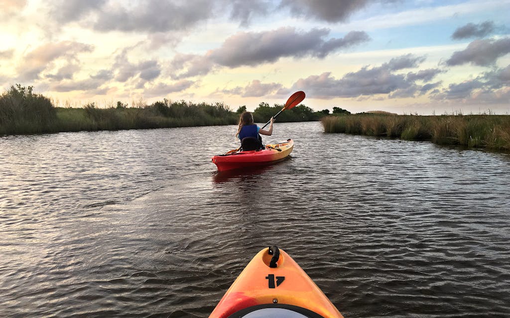
Another spot to check out after mosquito season has wound down is the marshland at Sea Rim State Park, a half-hour drive southwest of Port Arthur. You’ll still want to pack the bug spray; as park interpreter Madeline Martin says, “Fewer mosquitoes is a relative term.” In addition to beach camping, where wind keeps most of the insects at bay, paddlers can check out the only boat-in campsite operated by the Texas Parks and Wildlife Department. The four-mile round trip to that campsite follows wide, calm channels and is protected by reeds and other plant life from bigger waves in the nearby Gulf of Mexico. Explore the park through three paddling trails, which offer varying degrees of difficulty. Alligators aren’t uncommon in the marsh, but Martin says nesting season is over for the year, so they’re less active in late fall and winter. “We get a flyway right through here, so we have a pretty diverse community of birds,” she adds. Look for seaside sparrows and blue-winged teal, which are especially common in the park’s marsh estuaries during winter. Martin says her favorite thing about the park is the varied “habitat gradient” of coastal plants and animals along the marsh and the ocean. Rental canoes and kayaks are first come, first serve and cost $15 per hour. The park also offers fishing supplies and binoculars at no-cost. Sea Rim State Park, 409-971-2559.

Upper Brazos River
The Brazos is known as the crown jewel of Texas rivers for its length (in our state, it’s second only to the Rio Grande) and rich history. For centuries, Native Americans traveled along its banks, and sometimes they still do. “I tell people that if you camp out here with a canoe or kayak, you’ll see Comanche Indians riding horses,” said Buddy Rochelle, whose family has owned and operated Rochelle’s Canoe Rental in Graford, an hour’s drive west of Fort Worth, since 1969. In the fall, the scenery is especially beautiful. Rochelle says his grandmother has counted thirteen shades of leaves on the eastern cottonwood, smooth sumac, and cedar elm trees that trace the curves of the Palo Pinto Mountains across the river from their property. Paddlers can look up at that view from between rocky cliffs on a popular route stretching nineteen and a half miles. It begins below the Morris Sheppard Dam, which holds in Possum Kingdom Lake, and ends at Rochelle’s boat dock, with most people choosing to pack tents and camp out along public sandbars and low-lying banks on the river’s edge. Rochelle’s Canoe and Kayak Rental, 930-659-3341.
South Llano River
The three major clear and cold southwest Texas rivers—the Nueces, the Frio, and the Sabinal—often run low. That means they’re typically unnavigable in the fall and winter as the temperatures cool down. The spring-fed South Llano River, however, can be paddled year-round. Rhonda Thomas, who owns South Llano Canoes and Kayaks with her husband, Curtis, offers shuttles and boat rentals for paddling routes ranging from six to nine miles. The routes are right outside Junction, dubbed the “front porch of the West,” where visitors can traverse the last reaches of the Hill Country before it turns to desert. Thomas says the best thing about her less-visited slice of Texas is that paddlers can beat the crowds of some of the region’s more popular spots. A few small rapids offer just enough adventure to keep things exciting. South Llano River Canoes and Kayaks, 325-446-2200.
Devils River
There are few spots in Texas, a state of more than 29 million people, where you can spend uninterrupted days without seeing another soul. The Devils River is one of those places. In the desert, fall tends to blend in with other seasons. But on the Devils, which winds roughly forty navigable miles across West Texas, you can see the changing orange and brown leaves of sycamore trees along the bank. Don’t forget to look to the sky too: in October and November, monarch butterflies pass through the region on their biannual migration to Central Mexico. Gerald Bailey, who rents boats on the river, says that in a good year the region may see tens of thousands of monarchs. In the better years, they form small clouds that group together on the scrubby banks.
Planning a Devils River trip? Checking the flow levels and weather before you leave is a must. If the water levels are too low, you’ll be carrying heavy canoes full of food, camping supplies, and other gear over the dry river bed for several hundred yards, if not for miles. If the water is too high, rapids and current on the Devils can be deadly; the river is prone to flash floods. Optimal levels are between 100 and 200 cfs, but some paddlers make the trip when it’s as low as 60 cfs. Devils River Outfitters, 830-395-2266.
San Antonio Bay
I admit to a little bit of personal bias in selecting this route. The stretch of coastline an hour’s drive south of Victoria marks the last eighteen or so miles of the Texas Water Safari, which I completed last summer. Whether or not that grueling 262-mile race is in your future, the San Antonio Bay is a one-of-a-kind paddling experience. Your trip likely will involve sightings of alligators—some of which can be quite large, though they’re mostly harmless—and possibly dolphins. In the winter months, clouds of bloodthirsty mosquitoes can be more easily avoided. For the full eighteen-mile journey, paddlers can begin at Calhoun’s Riverside RV Retreat and see the last few mangrove-shaded miles of the Guadalupe River. It opens up suddenly into San Antonio Bay, where you’ll paddle alongside shrimping boats bringing in their catch. For a shorter trip, hug the shoreline between the Bayfront Park and Swan Point, at the end of the paddling trail. Before embarking, check wind levels, which can be dangerous when they rise above 10 miles per hour. Also steer clear of incoming rain and thunderstorms. There is no rental or shuttle operator in nearby Seadrift, but kayak rentals are available on a per-day basis at most REI locations and at Austin Canoe & Kayak, which has locations in Austin, Houston, San Antonio, and New Braunfels. Park two cars, one at the beginning and one at the end of your route. Austin Canoe & Kayak, 512-719-4386.


